Tracks records your GPS position as you travel, even with the app in the background, and keeps every trip as a logbook entry with its course, distance, time, and speed.
Record a track#
Start recording from any of these:
- Coastal Charts: tap Record in the sheet.
- Tracks: tap New Recording or the + icon.
- An empty Tracks list: tap Record Track.
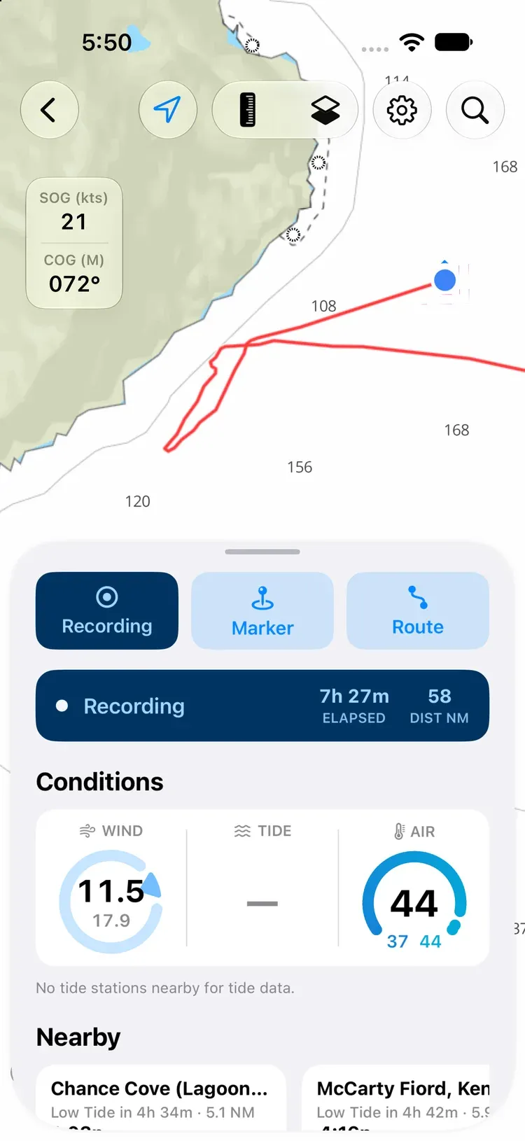
A strip on the chart shows Locating… until your device has a GPS fix, then Recording, with the elapsed time and distance. Tap it for:
- Save track: give it a name, or leave it blank to name it by date.
- Pause track and Resume track: a pause leaves a gap in the line if you move position.
- Delete track: throw the recording away.
Recording carries on when you switch apps or lock your phone, and a Live Activity on the Lock Screen shows the distance, time, and average speed. Tap it to go back to the recording.
On Android: recording carries on when you switch apps or lock your phone. A Recording track notification shows the distance, time, and average speed, with Pause (or Resume) and Save. Save from the notification names the track by its date; you can rename it in Tracks. Tap the notification to go back to the recording. On Android 16 and later the distance also shows in the status bar and on the lock screen. If you don’t see the notification, allow OceanPulse’s notifications in your phone’s Settings.
On Android: some phones, including many Samsung, Xiaomi, and OnePlus models, stop apps in the background to save battery, which can end a long recording. Before a passage, set OceanPulse’s battery use to Unrestricted; see Battery settings.
If OceanPulse is closed or crashes mid-recording, nothing is lost: every point is saved as it’s recorded. The next time you open the app, choose Resume Recording, Save Track, or Delete Track.
While recording, Tracks shows a card with the elapsed time, distance, and speed, and Pause, Save, Delete, View on Chart, and Share Live Track.
Your tracks#
In the sidebar, under Tools, tap Tracks. On iPad the list sits beside the map. You can also tap Tracks in the Coastal Charts Library.
- Search for a track by name.
- Sort and group: tap the … button to sort by date recorded, name, distance, or duration, and to group by date (Today, Yesterday, Previous 7 Days, Previous 30 Days).
- Pin: press and hold a track and choose Pin to keep it at the top.
- Delete: press and hold a track and choose Delete. It’s deleted straight away, so be sure.
Review a track#
Tap a track to see it on the map, with your other tracks faint behind it.
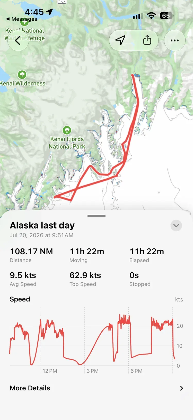
The card along the bottom shows Distance, Moving and Elapsed time, Avg Speed, Top Speed, and time Stopped, then a Speed chart. Drag along the chart and a marker shows where you were at that moment.
Tap Show Details for when it started and ended, the number of pauses and points, and whether it was recorded or imported.
Tap the … button at the top to Rename, Pin, or Delete the track.
Share a track#
Tap Share at the top:
- Share Web Link: a link anyone can open in a browser.
- Share GPX File: a GPX file for chart plotters and other apps.
- Create Share Image: a trip card with your route, distance, duration, and top speed, saved to Photos.
- Create Instagram Story: the same card, straight into an Instagram story.
On Android: Create Share Image opens the share sheet, so you can save the card or send it straight to an app. Create Instagram Story shows only when Instagram is installed.
Share a live track#
While you’re recording, you can send a link that lets family and crew follow along: on a chart in their browser, or in OceanPulse if they have it. Sharing a live track is part of OceanPulse Pro; following one is free.
- Tracks: on the recording card, tap Share Live Track.
- Coastal Charts: tap the recording strip, then Share live track.
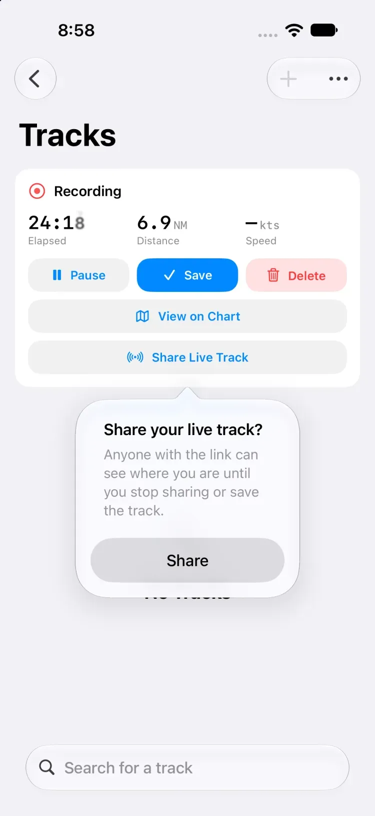
Tap Share, then send the link however you like. Anyone with the link can see where you are until you stop sharing or save the track. The link is titled with your first name, such as “Sam’s Live Track”.
While you share, the button on the recording card reads Sharing Live with when your position was last sent, such as “sent 8 s ago”, and the Tracks row in the sidebar shows a broadcast icon beside its recording dot. Out of signal, offshore for days even, positions wait on your device and go up as soon as you’re back in range; the button says no signal and how many are waiting.
On Android: the recording notification reads Recording track · Sharing live while you share.
To send the link again, or to stop, tap Sharing Live on the card, or the recording strip on the chart, and choose Send Link… or Stop Sharing.
A live track ends when you:
- Stop sharing, delete the recording, or sign out: the link stops working at once, and the track comes off every chart following it.
- Save the recording: followers keep the finished track for 24 hours, then the link ends.
Follow a live track#
Open a live track link on a device with OceanPulse and choose Follow. Coastal Charts opens on the track, which updates as the boat moves, with an arrow at its latest position pointing the way it’s heading. Not Now leaves you where you were.
On Android: if a live track link opens in your browser rather than in OceanPulse, open your phone’s Settings → Apps → OceanPulse → Open by default and turn on Open supported links.
Each track you follow has a card in Tracks with its speed, heading, and distance, and how long ago it was updated. Tap it, or View on Chart, to see it on the chart, and tap Stop Following to take it off. When the boat is paused, its card says when the pause began.
If the boat goes quiet for more than 15 minutes, out of signal mid-ocean say, the track turns grey and its card says how long it’s been, with the time of the last position. It stays on your chart, and fills in the moment the boat is back in range.
Without the app, the link opens the track on a chart in any browser, with the same details.
Tracks on the chart#
Your saved tracks show on Coastal Charts too. To hide them, tap Settings on the chart, then Chart Display, and turn off Show saved tracks.
Import a GPX track#
Open a .gpx file with OceanPulse, from Files, Mail, Messages, or AirDrop. The
track appears in Tracks, marked as imported.
On Android: open the file from Files, Gmail, Drive, or your downloads and choose OceanPulse, or tap Settings on Coastal Charts, then Import GPX.
Sync#
Your tracks sync across your iPhone and iPad through iCloud.
On Android: tracks are kept on the phone or tablet that recorded them. To keep a copy elsewhere, share a track as a GPX file to Drive or Files.
The tracks feature is free.