Satellite Clouds shows the clouds as five weather satellites see them, over the whole planet, as a loop of the last four hours. It’s part of OceanPulse Pro.
Open Satellite Clouds#
In the sidebar, under Conditions, tap Satellite Clouds. The map starts over the Atlantic and moves to your location once your device knows where you are. Tap Center on My Location at the top right to fly back to it at any time.
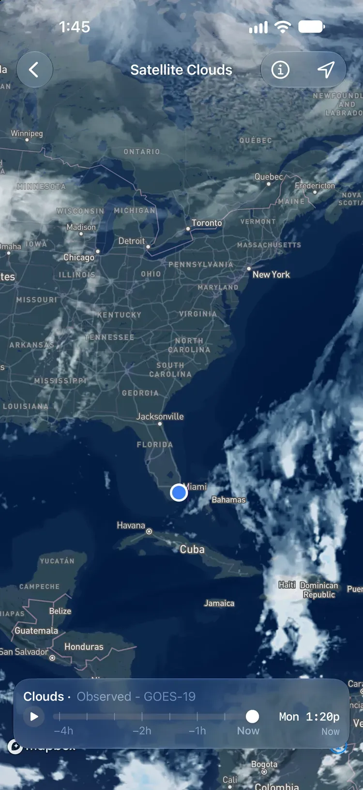
Zoom out to see the whole globe, or in to see detail down to about 2.4 km.
Play the loop#
The card along the bottom reads Clouds · Observed - and the name of the satellite whose image is in the middle of the map.
- Tap play to run the last four hours. The loop ends on Now, pauses for a moment, then starts again.
- Drag the handle to step through the frames, one every 10 minutes. The readout on the right shows the day and time, with how long ago it was underneath, like −1h30m.
- While the frames load, the readout counts them in.
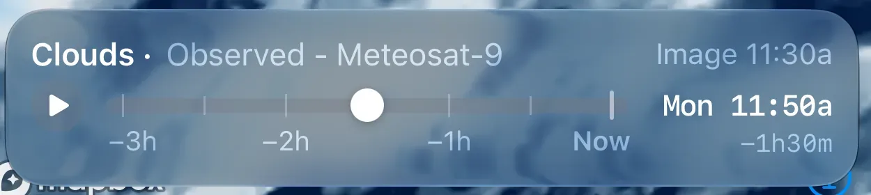
Each frame uses the newest image every satellite had sent by then, and some send theirs later than others. When the image in the middle of the map is 15 minutes or more older than the frame, the card says when it was taken, like Image 11:30a.
Read the picture#
Satellite Clouds is an infrared picture. It sees clouds by how cold their tops are, so it works the same by day and by night.
- High, cold clouds show white.
- The coldest tops, at the top of thunderstorms and tropical storms, turn light blue. The bluer the cloud, the taller the storm.
- Low clouds are close to the temperature of the sea below them, so they show faintly or not at all. Fog and low cloud can be there even where the map looks clear.
Satellite Clouds shows the clouds that are there now, or were in the last four hours. It doesn’t forecast them. For cloud and rain in the days ahead, use the Cloud and Rain layers in Weather Maps. For the rain falling now across the US, use Rain Radar.
The satellites#
Each satellite hangs over one spot on the equator, about 36,000 km up, and sees the same disk of the Earth every time.
| Satellite | Run by | Watches |
|---|---|---|
| GOES-19 | NOAA | The Americas and the western Atlantic |
| GOES-18 | NOAA | The eastern and central Pacific |
| Himawari-9 | JMA | Asia, the western Pacific, and Australia |
| Meteosat-12 | EUMETSAT | Europe, Africa, and the eastern Atlantic |
| Meteosat-9 | EUMETSAT | The Indian Ocean |
Where their views overlap, OceanPulse blends them, leaning on the satellite that sees the place most directly. Toward the poles, and anywhere a satellite’s image is missing, NOAA’s GMGSI fills in: an hourly mosaic of the world’s weather satellites.
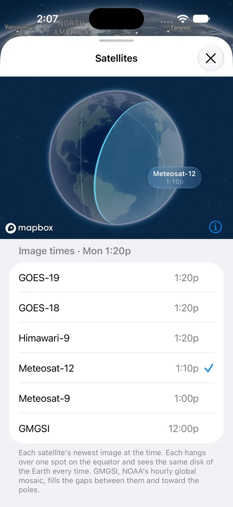
Tap Satellites, the i at the top right, to see them all.
- Image times lists when each satellite took its image for the frame you’re on. It follows the timeline, so the times change as you drag. Not in this frame means that satellite’s image was missing.
- The globe shows the part of the Earth each satellite sees. Tap a satellite in the list, or tap the globe, and its view fills in the way its camera scans the Earth: north to south for GOES and Himawari, south to north for Meteosat. Then its name and image time appear.
Coverage#
Satellite Clouds covers the world from 72.7°N to 72.7°S. Beyond that the map is hatched. Past about 64° north and south the picture comes from GMGSI alone, so it changes only once an hour there.
The map is also hatched anywhere a frame has no image, so a missing picture never looks like clear sky. At some hours GMGSI has no image of part of the Arctic, such as the Barents and Kara Seas.
See every satellite’s reach on the coverage map.
Updates and connection#
Most of the satellites send a new image every 10 minutes (Meteosat-9 every 15), and OceanPulse makes a new frame every 10 minutes. An image reaches the map about 20 minutes after it’s taken. OceanPulse checks for a new frame every 90 seconds while Satellite Clouds is open.
Satellite Clouds needs an internet connection. If it can’t load you’ll see Couldn’t load clouds. Check your connection. Tap Try Again once you’re back online. If a later refresh fails, the frames you already have stay on screen.
Pro#
Satellite Clouds is part of OceanPulse Pro.
Satellite images: NOAA GOES and GMGSI; Himawari-9 data (JMA) via NOAA, modified; contains modified EUMETSAT Meteosat data 2026.