Forecast · Tables & Graphs
Every model. Every hour. One table.
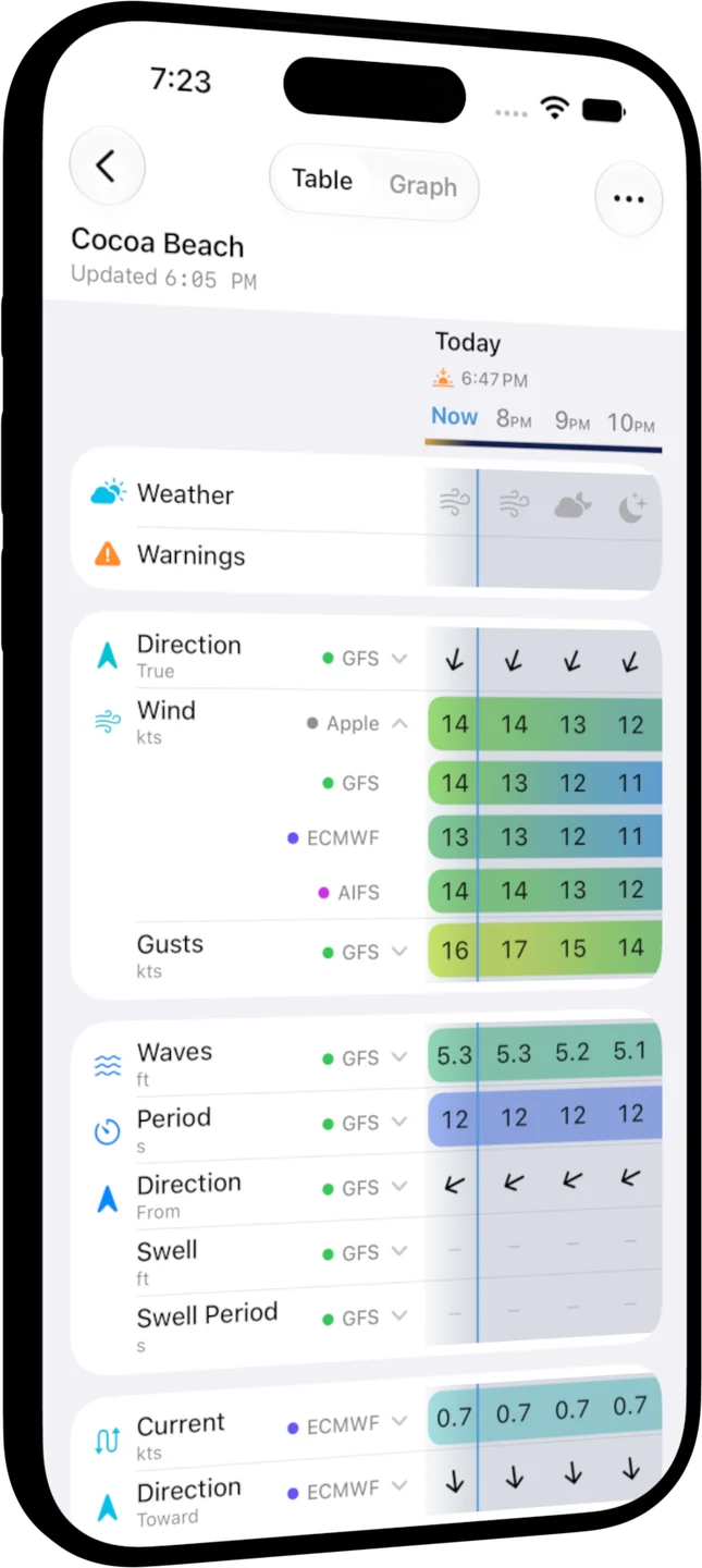
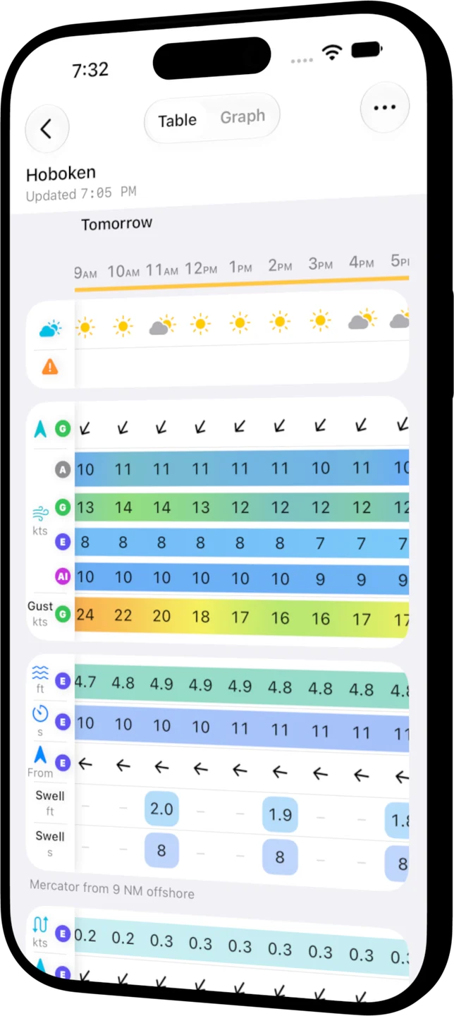
Ten days of wind, waves, currents, sea temperature, rain, and more for any place, hour by hour, with the world's leading forecast models side by side so you can see where they agree.


Compare the models
Don't bet the day on one forecast
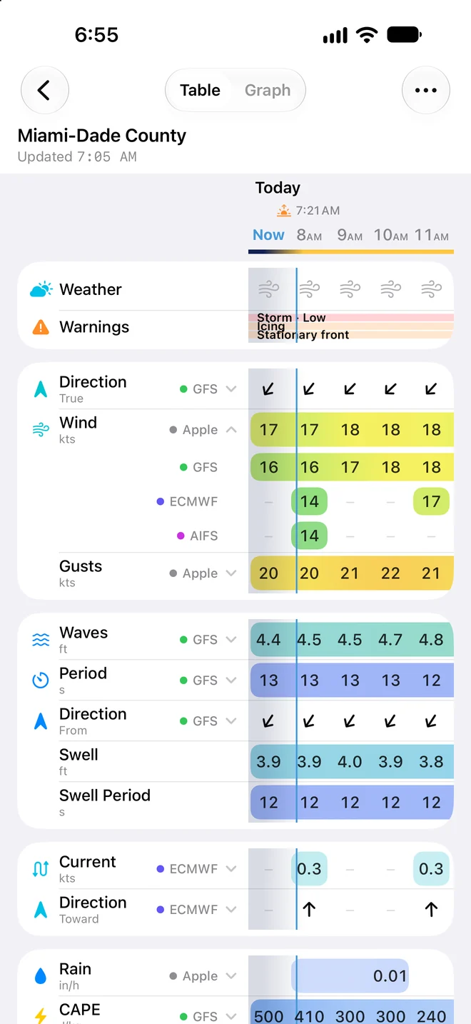
Tap any row and it opens into one line per model. Where Apple, GFS, ECMWF, and AIFS agree, go with confidence; where they split, you'll know before you leave the dock.
- Seven models, named on every row
- Apple Weather; NOAA's GFS, RTOFS, and Geo-Polar Blended; ECMWF and its AI model AIFS; and Copernicus Marine's Mercator, each with its own colour.
- Pick the one you trust
- Collapse a row onto any model and OceanPulse remembers it, row by row.
- Gaps stay honest
- When a model doesn't forecast an hour, you see a dash, not a guess.
Everything on the water
Read it at a glance
Colour carries the strength, so a building breeze or a rising sea jumps out before you read a number. Arrows point the way things are moving, and night hours are shaded from sunset to sunrise.
- Conditions
- Weather and the marine warnings in force
- Wind
- Direction, speed, and gusts
- Sea
- Wave height, period, and direction; swell and swell period; and sea temperature
- Currents
- Current speed and direction
- Sky
- Rain and cloud cover, plus CAPE for thunderstorm risk (with Pro)
- Air
- UV, temperature, pressure with its trend, and visibility
Your places
Every spot you care about
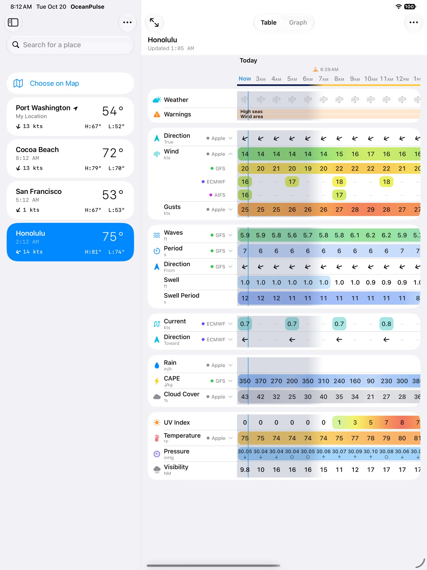
Your location, your home port, the inlet you run, and the ledge 40 miles out: save a town or drop a point anywhere on the water. On iPad the list sits right beside the table.
Make it yours
Only the rows you read
Hide the rows and models you never look at, step the table every hour or every three, and set your units once for the whole app.
- Follows you everywhere
- Your table setup syncs across your iPhone and iPad through iCloud.
- The same table on the chart
- Press and hold anywhere on the chart, or open a marker, for the forecast right there.
- Warnings built in
- Marine alerts in force around the place sit at the top of the table. Tap for the full list.
User guide
Learn Tables & Graphs inside out
Read an hour-by-hour forecast for any place, compare weather models side by side, and set the table up the way you like it.
There's more
More from OceanPulse
- Daily Summary Ten days for every place you've saved, each split into morning, afternoon, evening, and overnight.
- Weather Maps Wind, waves, currents, sea temperature, rain, and more, animated across the whole planet three days ahead, with a split view to compare models.
- Tides & Currents Offline predictions at about 5,800 NOAA tide and current stations, with high and low water, slack, and max flood and ebb.
- Solunar Sunrise, sunset, every twilight, and the moon's rise, set, and phase for any place, even offline.
- GMDSS Official marine safety broadcasts and warnings, read for you and placed on the map.
- Coastal Charts Official NOAA charts for the US, the Great Lakes, and US territories, with markers, routes, and offline downloads.
Ready to dive in?
Start using OceanPulse today.