Forecast · GMDSS
Every high-seas warning, on one map.
The official forecasts and warnings broadcast to ships at sea, for almost every ocean on Earth, word for word. With Pro, see the storms, fronts, and warning areas they describe drawn on a globe and played forward.


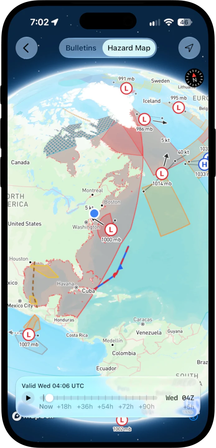
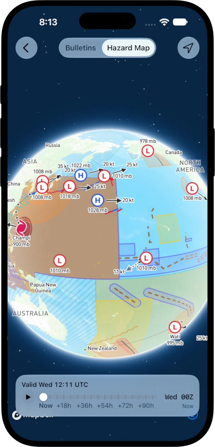
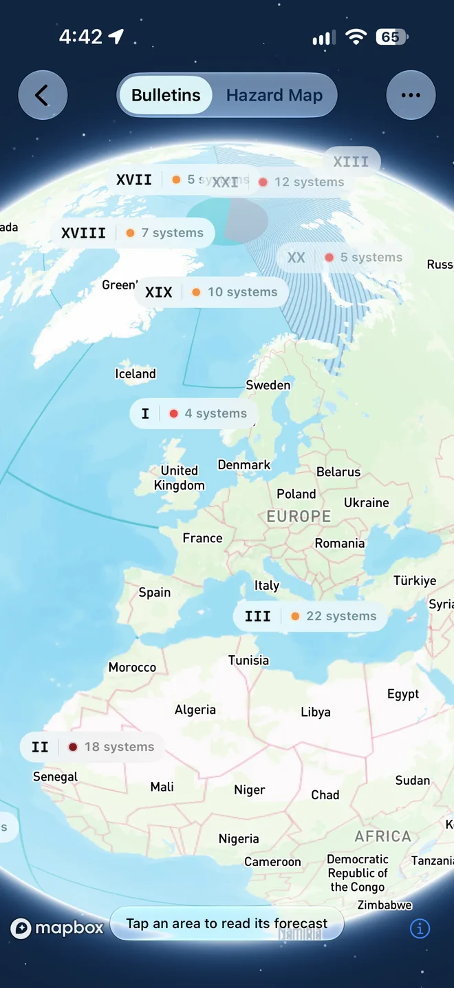
Official, word for word
The bulletins ships rely on
Every METAREA has a national weather service broadcasting its high-seas forecasts and warnings. OceanPulse gathers them from the World Meteorological Organization's service and shows each one exactly as issued, free.
- Almost every ocean
- 20 of the 21 METAREAs, from NOAA, the Met Office, Météo-France, the Japan Meteorological Agency, and more.
- Always the latest
- OceanPulse checks for new bulletins every 15 minutes.
- Still there offshore
- The last bulletins you loaded stay on your device when you lose signal.
The Hazard Map
See the storms, not just read about them
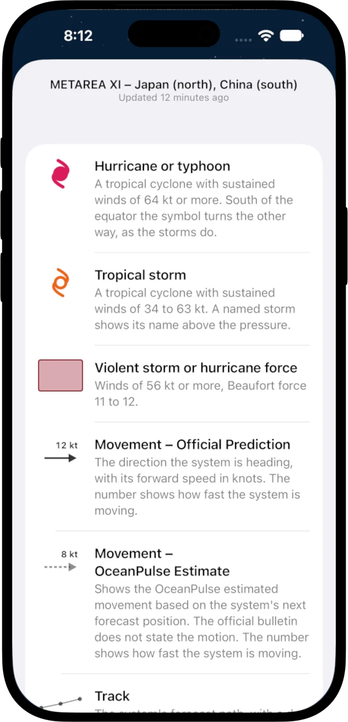
OceanPulse reads every bulletin and draws what it describes: lows and highs, tropical storms and hurricanes, fronts and ice edges, and every warning area, shaded by wind strength. Step up to four days ahead and watch them move.
Warning areas
- Strong wind
- 22–33 kt
- Gale
- 34–47 kt
- Storm
- 48–55 kt
- Violent storm or hurricane force
- 56 kt and up
Every system links back to the bulletin it came from. The Hazard Map is OceanPulse's reading of the bulletins, so check the original before you act on it.
Alerts that find you
Know what's near you
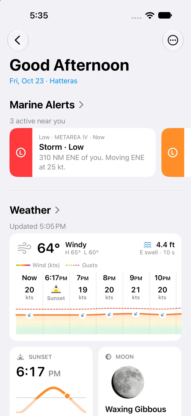
Home lists the systems heading your way over the next two days: tropical systems within 400 miles, storms within 250, gales within 150. The same alerts show on Daily Summary and in the forecast table, free.
- Ranked by what matters
- Each alert shows how far away the system is and when it's closest.
- One tap to the source
- Press and hold any alert to read the official bulletin.
On iPad
A whole ocean basin at once
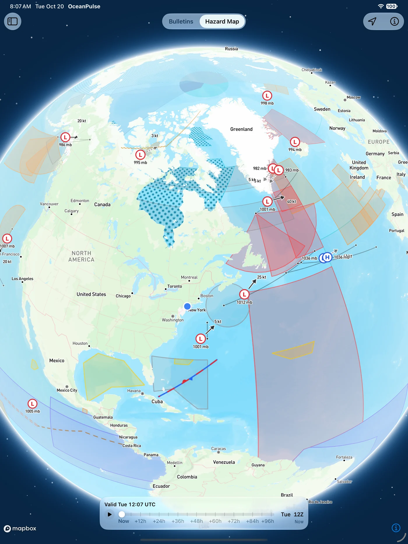
Official warnings are broadcast by radio and satellite. OceanPulse is for information only and doesn't replace receiving the official broadcasts.
User guide
Learn GMDSS inside out
Read the official high-seas forecasts and warnings for almost any ocean, and see the storms, fronts, and warning areas they describe drawn on the map.
There's more
More from OceanPulse
- Daily Summary Ten days for every place you've saved, each split into morning, afternoon, evening, and overnight.
- Weather Maps Wind, waves, currents, sea temperature, rain, and more, animated across the whole planet three days ahead, with a split view to compare models.
- Tables & Graphs A ten-day, hour-by-hour forecast grid for any place, with Apple, GFS, ECMWF, and AIFS side by side.
- Tides & Currents Offline predictions at about 5,800 NOAA tide and current stations, with high and low water, slack, and max flood and ebb.
- Solunar Sunrise, sunset, every twilight, and the moon's rise, set, and phase for any place, even offline.
- Coastal Charts Official NOAA charts for the US, the Great Lakes, and US territories, with markers, routes, and offline downloads.
Ready to dive in?
Start using OceanPulse today.