Ships at sea get their weather warnings through GMDSS, the Global Maritime Distress and Safety System. The world’s oceans are split into 21 “METAREAs”, and each has a national weather service that broadcasts high-seas forecasts and warnings for it. OceanPulse gathers those bulletins in one place, word for word, and with Pro draws the storms and warning areas they describe on a map.
Official warnings are broadcast by radio and satellite. OceanPulse is for information only and doesn’t replace receiving the official broadcasts.
Open GMDSS#
In the sidebar, under Forecast, tap GMDSS. The switch at the top moves between Bulletins and Hazard Map.
Alerts also reach you from elsewhere in the app:
- Home: the Marine Alerts section lists systems near you. Tap its header to open GMDSS, or a tile to go straight to that system.
- Daily Summary: tap an alert badge on a period card.
- Tables & Graphs: the Warnings row shows the alerts around a place; tap it for the full list.
Read the bulletins#
Bulletins shows the METAREAs on the map. Each label has the area’s number and how many systems are in force there, with a dot colored by the strongest warning. Tap an area to read its forecast.
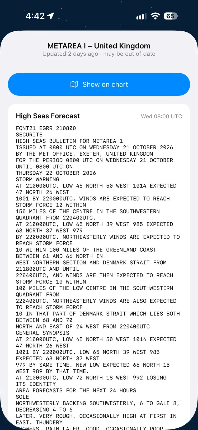
The sheet shows every bulletin in force for the area: the product name (such as HIGH SEAS FORECAST or TROPICAL CYCLONE WARNING), when it was issued in UTC, and the full text exactly as the weather service wrote it. You can select and copy the text.
If the line under the title says may be out of date, OceanPulse hasn’t been able to check for new bulletins for a couple of hours.
Bulletins are free, for every area OceanPulse covers. Areas it doesn’t cover are hatched.
The Hazard Map#
Hazard Map draws what the bulletins describe on a globe you can spin and zoom. It’s part of OceanPulse Pro.
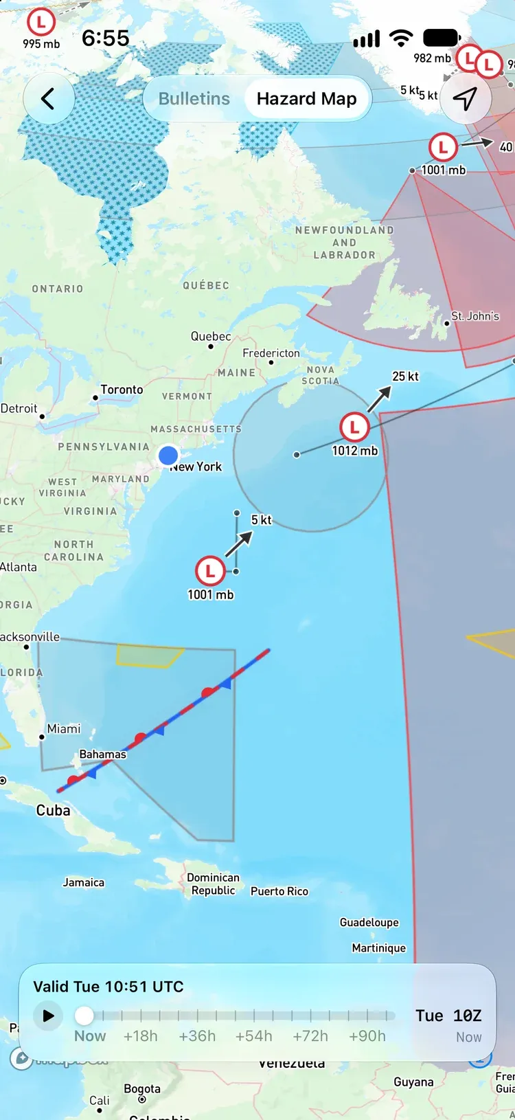
- Systems: lows (L) and highs (H) with their central pressure, tropical depressions, tropical storms, and hurricanes.
- Movement: arrows show where a system is heading and how fast, in knots, and lines show its forecast track.
- Fronts, troughs, ridges, the ITCZ, and ice edges are drawn the way weather charts draw them.
- Warning areas are shaded by wind strength:
| Colour | Warning | Wind |
|---|---|---|
| Yellow | Strong wind | 22–33 kt |
| Orange | Gale | 34–47 kt |
| Red | Storm | 48–55 kt |
| Crimson | Violent storm or hurricane force | 56 kt and up |
Fog, icing, sea ice, volcanic ash, heavy seas, and thunderstorms have colors of their own. A dashed edge means the area’s position is approximate, and a faint wash with no edge means the bulletin only says “somewhere in this METAREA.”
Step through the forecast#
The timeline along the bottom starts at Now and runs as far ahead as the bulletins go, up to four days. Drag the handle or tap play to watch the systems move. The header shows the time on the map, like Valid Tue 10:51 UTC. Bulletins and the Hazard Map use UTC time.
Tap a system#
Tap a center, a line, or a shaded area to open its details: the strongest wind and gusts, central pressure, and how it’s moving, for each step of the forecast. The step on the map is marked On chart. Tap Read the official bulletin for the original text.
Where systems overlap, OceanPulse asks which one you mean. Tap open water to read that area’s bulletins.
Chart Guide#
The Chart Guide explains every symbol, line, and colour. Tap the info button at the top right; on iPhone it’s in the … menu.
On Android: on a phone it’s in the ⋮ menu.
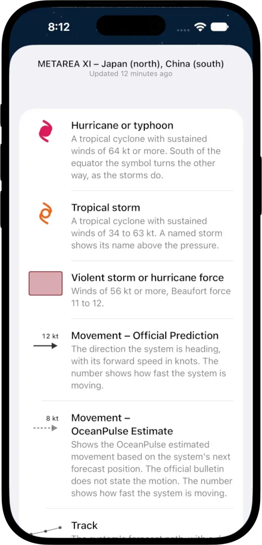
The guide tells two kinds of movement apart. Movement – Official Prediction is the speed and direction the bulletin states. Movement – OceanPulse Estimate is worked out by OceanPulse from the system’s next forecast position when the bulletin doesn’t give one.
How the map is made#
OceanPulse reads each bulletin as it’s issued, using AI, and turns it into shapes on the map. It checks positions against the bulletin’s coordinates, named sea areas, and place names.
Marine alerts near you#
Home’s Marine Alerts section lists the systems near your location from the last three hours to two days ahead:
- tropical systems within 400 NM
- storms within 250 NM
- gales within 150 NM
- other warnings within 50 NM
Press and hold a tile and choose Read the Official Bulletin for the original text. Marine Alerts are free. For Pro users, tapping a tile opens the system on the Hazard Map.
Updates and offline#
OceanPulse checks for new bulletins every 15 minutes, though most weather services reissue only every few hours. GMDSS loads the latest each time you open it.
The last bulletins and when they were issued are saved to your device so you can read them offline.
- Bulletins Unavailable: OceanPulse couldn’t reach the bulletins. Check your connection and open the area again.
- Nothing in Force: no bulletins are current for that area.
- Couldn’t load the hazards. Check your connection. The Hazard Map couldn’t load; open it again once you’re back online.
Free and Pro#
- Free: the Bulletins map and every bulletin’s full text, Home’s Marine Alerts, the Warnings row in Tables & Graphs, Daily Summary’s alert badges, and the Chart Guide.
- Pro: the Hazard Map, including the timeline and system details, and Show on chart in a bulletin.