Now available for iPhone and iPad
Predict the ocean.
Charts, weather, tides — everything you need in one place. It's like Google Maps for boats, with predictive ocean intelligence built in.

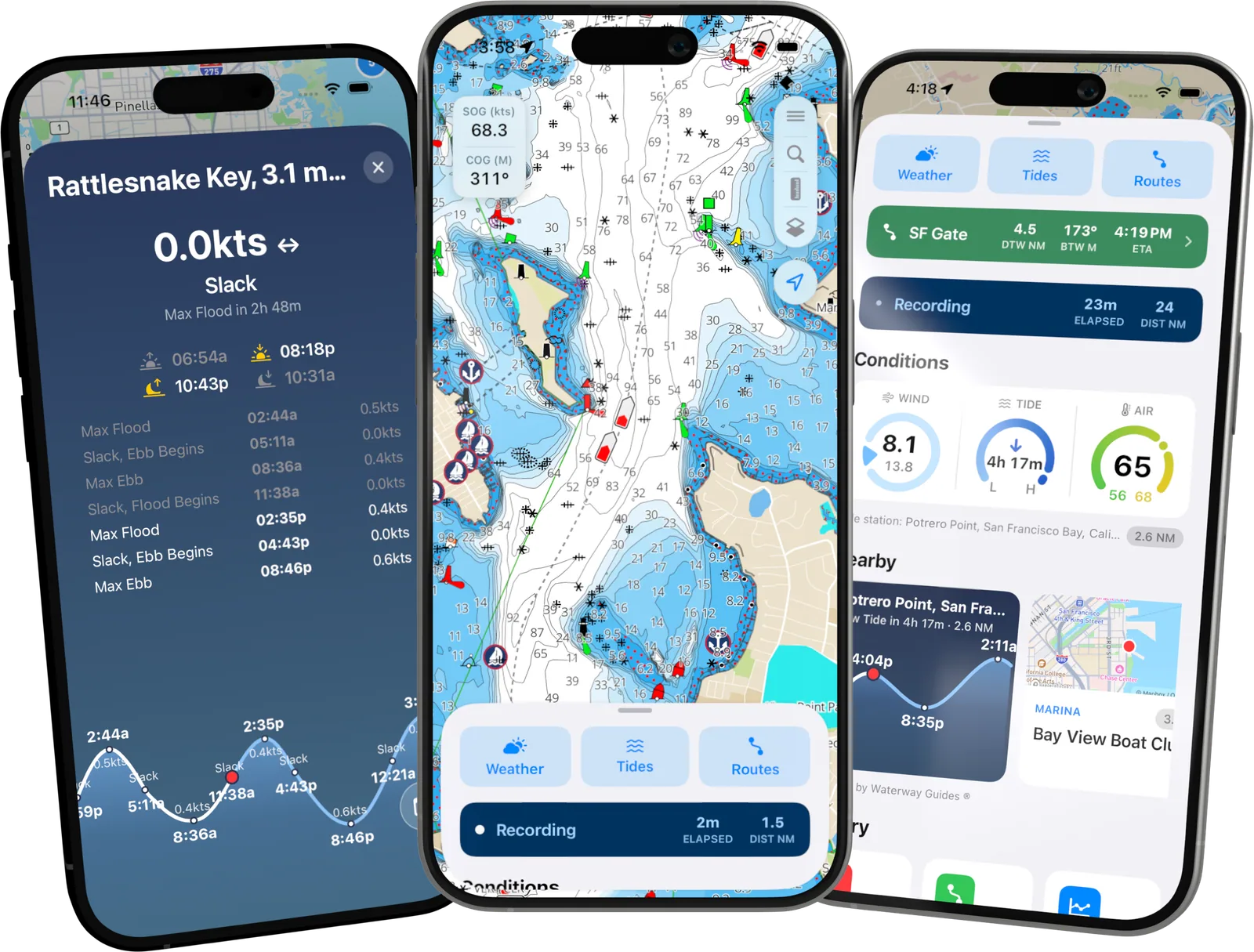
- 10,000+
- downloads
- 4.6 / 5
- average rating
- 3,000+
- tide & current stations
“When I found myself at night and in unfamiliar waters, I had one friend checking the water depth with a pole and another looking for a boat nav app. Luckily we found OceanPulse. We were able to navigate home and I've been a user ever since.”
“Depth and soundings are accurate, works well off the coast. It's the best water nav app I found.”
“OceanPulse is dead simple to use and has free chart data and offline downloads. Finally a modern boat navigation app!”
“I use it every day fishing in the Long Island Sound, usually around Block Island or Newport. Great for tides, winds, weather. I mark all my favorite fishing spots and use the live location sharing when my buddies are out on the water. Great app. 5 stars!”
Tides & currents
Know the water before you get there
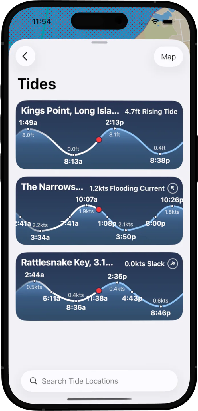
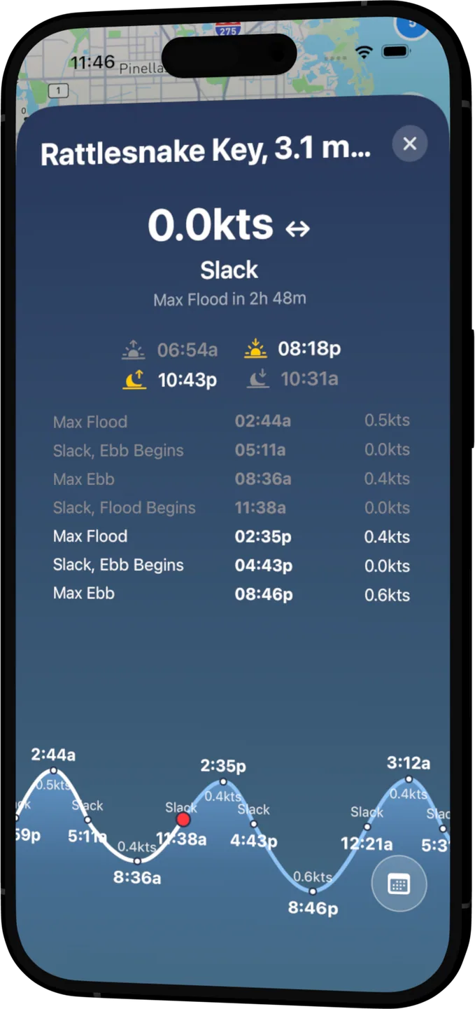
Slack, flood, and ebb for more than 3,000 stations across the US — computed on your device, so predictions are always there when the signal isn't.
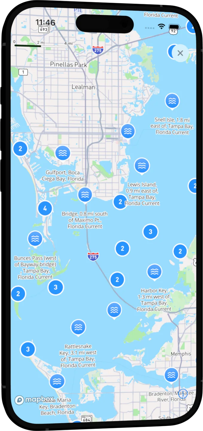
- 3,000+ stations
- Every NOAA tide and current station, mapped around you.
- The day at a glance
- Rising, falling, slack — scan every nearby station in one list.
- Plan the window
- Full curves for any day — years ahead, no connection needed.
Tracks
Every trip becomes a story
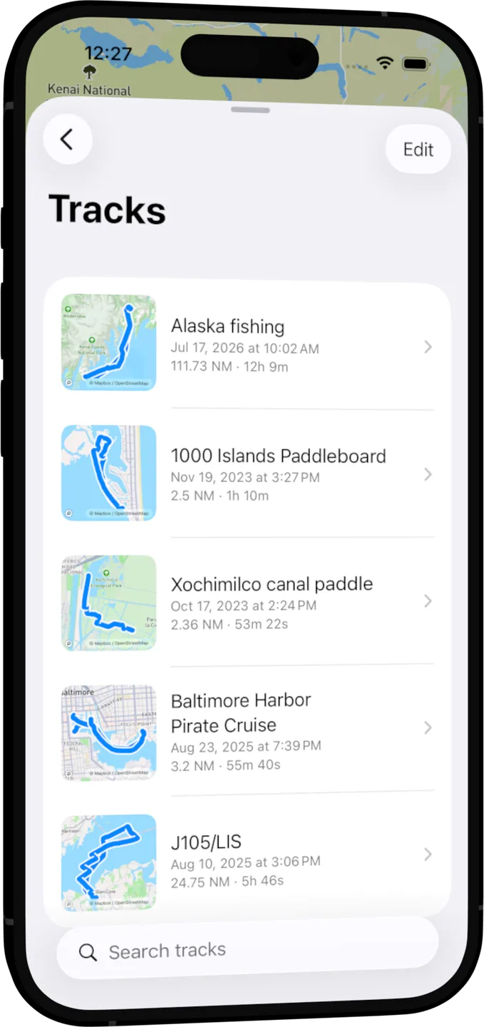
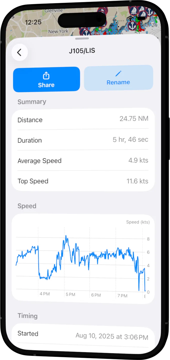
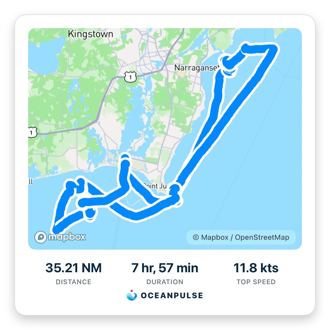
Tap record and drive the boat. OceanPulse quietly logs your course, then turns it into a keeper — stats, a speed graph, and a trip card made for sharing.
- Your logbook, on autopilot
- Every recorded trip lands in your logbook with its course drawn on the chart — named, dated, and easy to find.
- Stats the moment you dock
- Distance, duration, top speed, and a full speed graph — computed automatically the moment you save.
- Made to be shared
- One tap turns any trip into a ready-to-post image — your route, your numbers, your bragging rights.
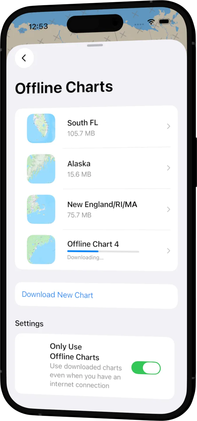
Offline charts
No signal? No problem.
The best chart plotter is the one that still works past the breakwater. Take your charts with you and navigate like nothing changed.
- Unlimited, and free
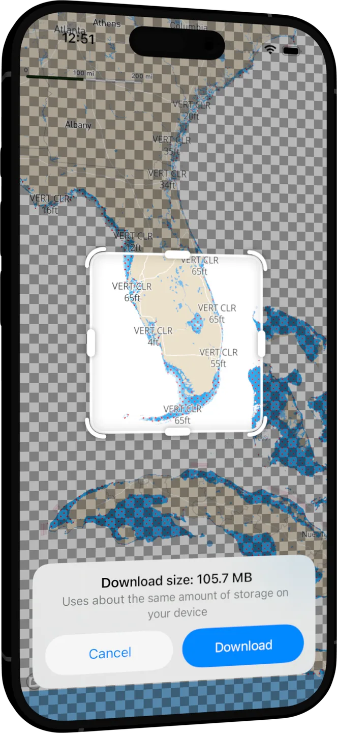
- Download as many chart regions as you like. Offline support matters too much to charge for.
- No surprises
- See the download size before you commit, and manage every region from one place.
- Offline-first switch
- Flip one toggle and OceanPulse runs entirely from your device — perfect for slow marina Wi-Fi and none at all.
On the chart
Everything the water's telling you
Official NOAA charts, layered with the context that turns a map into a plan.
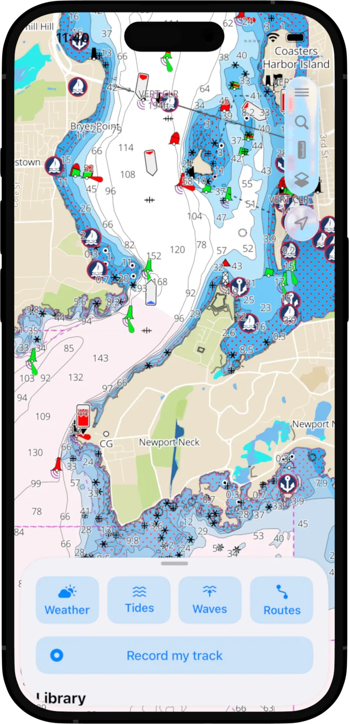
Free NOAA charts
You already paid for these charts with your tax dollars. Every buoy, depth, and hazard for the US, the Great Lakes, and US Territories — free, online and off.
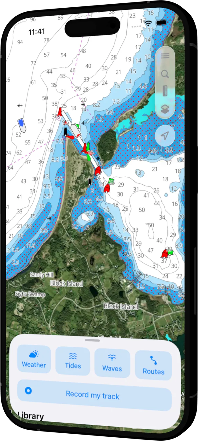
Satellite overlays
Flip on satellite imagery to scout anchorages, sandbars, and your next beach stop before you commit the keel.
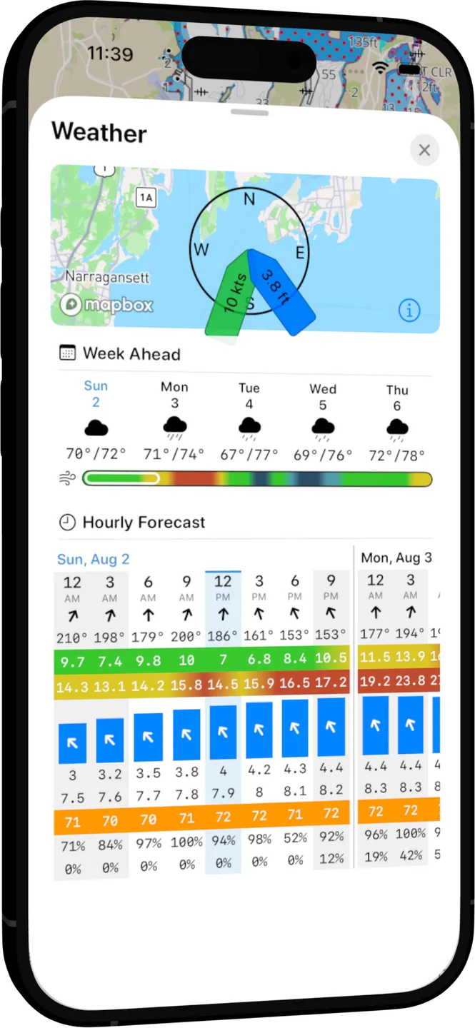
Weather built in
Week-ahead and hour-by-hour forecasts from leading models — wind, waves, and rain right where you're headed.
At the helm
Turn it sideways
Landscape mode was made for the helm mount. Your position on the chart, live wind and sea conditions in the corner, and the channel ahead — all in one steady glance.
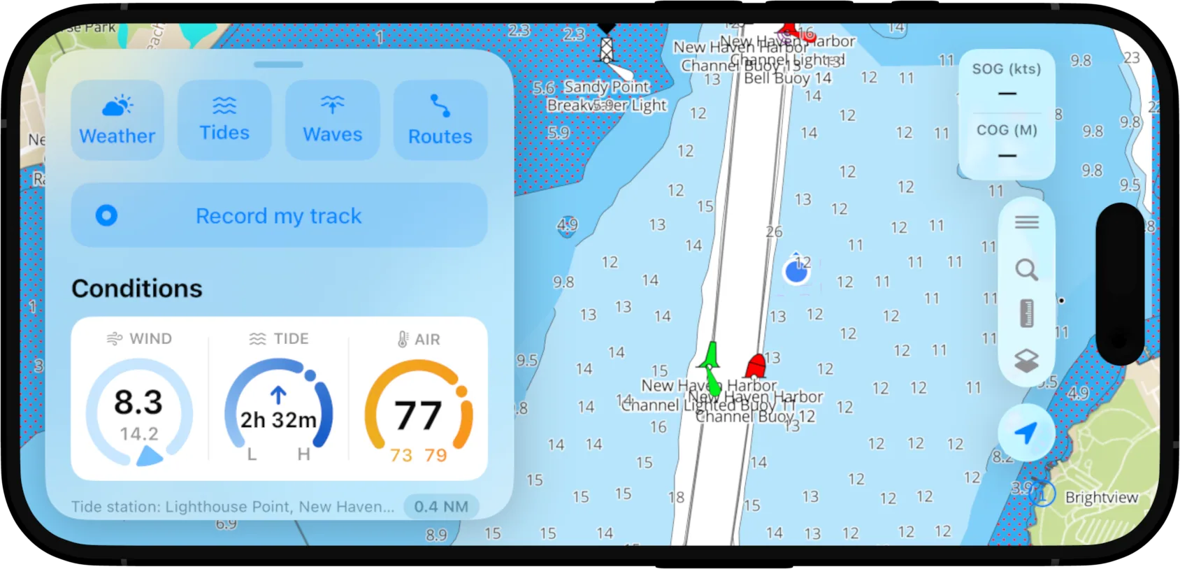
iPhone + iPad
A chart table for the whole crew
The full OceanPulse experience, at nav-station scale. Tap anywhere on the chart for conditions, currents, and detail — on a screen everyone can read.
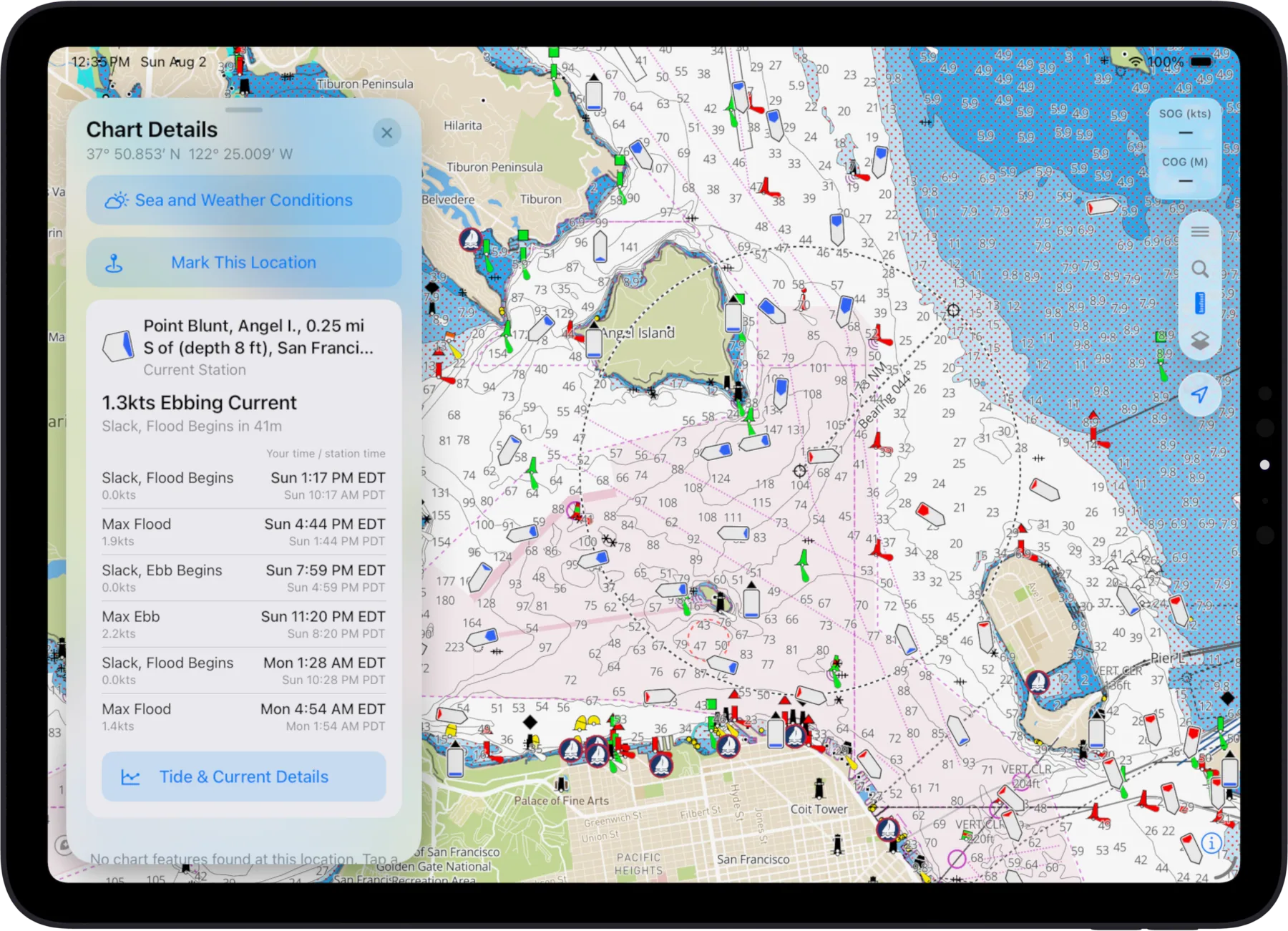
Coverage
Charts wherever you cast off
Explore the actual chart cells OceanPulse ships — every official NOAA chart, rendered from the same data the app navigates with. We'll expand more globally in the future.
- United States
- Full NOAA coverage, coast to coast
- The Great Lakes
- Every lake, every harbor
- US Territories
- Puerto Rico, USVI, Guam, and more
The details
And a whole lot more
- Markers
- Drop and organize your favorite spots.
- Routes
- Plan multi-leg trips point by point.
- Tracks
- Record where you've been, automatically.
- Distance measurements
- Measure any leg in a tap.
- GPX exports
- Take your data anywhere. No lock-in.
- Heading line
- See exactly where your bow points.
- Custom depth shading
- Shade depths to match your draft.
- Safety depth
- Highlight water too thin for your keel.
- Location sharing
- Share your live position with friends.
- Weather data
- Wind, rain, and pressure at a glance.
- Information tool
- Tap any chart object for details.
- User driven
- Built with feedback from real boaters.
Stay in the loop
Want product updates?
New features, expanded coverage, product announcements — straight to your inbox. We never share your data. Read our Privacy Policy.
Thanks! Your email was submitted successfully.
Something went wrong — please try again later.
Questions
Frequently asked questions
What chart coverage is included?
OceanPulse provides chart coverage for the US, the Great Lakes, and US Territories, using official NOAA data at no extra cost. We'll expand more globally in the future, and we promise to keep chart data at as low a cost as possible.
Does it work offline or in low bandwidth conditions?
OceanPulse is designed for low bandwidth conditions. Charts, weather data, and GRIB files are stored on your device until expiry, and only the minimal amount of data is sent over the wire. A data connection is required for the auto routing feature.
What weather models are included?
Weather features are delivered across leading models including ECMWF, GFS, and UKMO, so you can compare predictions side by side. We expect to selectively grow the providers over time.
How often is the weather data refreshed?
All weather predictions are updated on an aggressive rolling basis. As soon as our data providers publish new data, it's available in OceanPulse within 15 minutes or less.
What devices are supported?
OceanPulse is available on iOS and iPadOS, with macOS support on the way. We expect to launch a web version by the end of 2026.
Ready to dive in?
Start using OceanPulse today.