Support · Low Bandwidth Mode
Offshore on a trickle of data.
One switch for satellite, 3G, and other slow or costly connections. OceanPulse stops fetching on its own, shows the size of every download before it starts, and counts what you've used.


Measured
Small enough for a satellite link
- 7.7 KB
- A ten-day forecast for one place
- 32 KB
- Ten days, hour by hour, from every model
- ⅓
- The size of a weather map's wind, against the same map before
When it's enabled
You choose every download
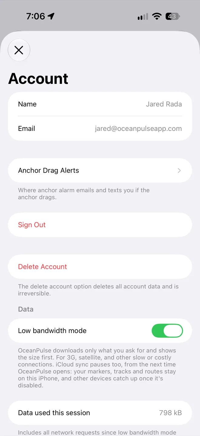
Turn it on in Account, under Data. A banner on each screen says the mode is enabled, and everything the app needs from the internet becomes a button with a size on it.
- Nothing downloads by itself
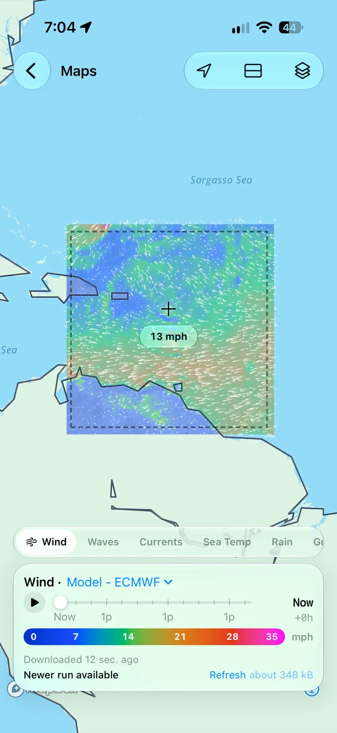
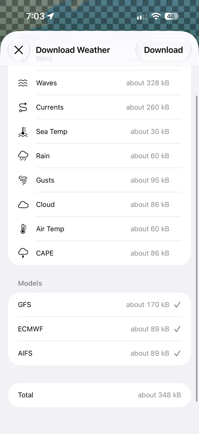
- Every screen waits for you. Where OceanPulse would have fetched something, there's a Download button with its size on it, so you decide what the connection is spent on.
- Weather for the water you choose
- Frame an area in Weather Maps and download its whole forecast, up to 16 days ahead. Weather Replay, Climate Trends, Rain Radar, and Satellite Clouds download the same way, and each says when it was downloaded.
- Forecasts on request
- Daily Summary, Tables & Graphs, GMDSS bulletins, and your Forecast Alerts each download with a tap and stay readable offline afterwards.
- Charts from your downloads
- The chart draws only the offline charts you've downloaded, so nothing is fetched as you pan. Download the waters you'll sail before you leave the dock.
- Routes in one download
- Weather Routing tells you about how much a passage will download, then brings the finished routes back whole. The race animation is left out.
- Followed from home
- Family and crew can follow your live track offshore. Your newest position goes up every hour, every 4 hours, or only when you ask, and Account shows what that comes to in a month.
- The anchor alarm keeps watch
- The alarm runs on the device aboard with no connection at all. Live sharing of the watch pauses, and a drag alarm still goes out to your crew whenever there's a connection.
- iCloud waits
- Sync pauses from the next time OceanPulse opens. Your markers, tracks, and routes stay on the device, and your other devices catch up once the mode is disabled.
- Tides and instruments as ever
- Tides & Currents and Solunar work everything out on the device, and NMEA Connect reads your boat's own WiFi, so all three work as always.
In Account
One switch, and a running total
Turn the mode on in Account, under Data. While it's enabled, Account counts the data OceanPulse has used since you turned it on, every request the app makes, so you can watch the satellite bill as you go.
- A banner on every screen
- Each screen says when the mode is enabled, with a link to disable it.
- Disable it any time
- Turn the switch off and OceanPulse goes back to keeping itself up to date. iCloud sync resumes the next time the app opens.
Going offshore
On the link you already have
OceanPulse needs no hardware of its own and no special data plan. Charts, tides, the anchor alarm, and your instruments need no connection at all, and weather, routes, and bulletins come down whatever link is aboard.
- Starlink
- Fast enough that OceanPulse works as it does ashore. On a plan billed by the gigabyte, low bandwidth mode keeps it to what you ask for.
- Iridium GO! exec
- A whole forecast for the water ahead in about two minutes, a finished route in seconds, and a position for your followers in about 6 KB.
- Roaming and hotspots
- Abroad on a roaming phone or a marina's metered Wi-Fi, the same switch keeps the bill to the downloads you choose.
What to download before you leave, and what each download costs: Going Offshore
On every plan
Lighter even when it's off
The work behind the mode makes OceanPulse lighter for everyone. Forecasts, tables, and weather maps are compressed on the way to your device, and data that hasn't changed isn't sent again. Low bandwidth mode itself is part of OceanPulse Elite.
User guide
Learn Low Bandwidth Mode inside out
For satellite, 3G, and other slow or costly connections. OceanPulse downloads only what you ask for, shows the size first, pauses iCloud sync, and totals the data you've used.
There's more
More from OceanPulse
- Marine Charts Official NOAA charts for the US, the Great Lakes, and US territories, plus the major inland rivers and more than 5,500 inland lakes, with markers, routes, and offline downloads.
- Tracks Record your trips and share them live as you go (Elite), then review, search, and export them, with distance, time, and speed for each.
- Forecast Alerts Set the wind, waves, tide, and weather you want at a spot, and get a push or an email when the forecast matches.
- Anchor Alarm Leave an iPhone or iPad aboard to watch the anchor. It sounds an alarm if the boat drags, loses GPS, or runs low on battery, and your phone follows along ashore.
- Weather Routing Pick a start and an end, and watch GFS, ECMWF, and AIFS race to the fastest route for your boat, modeled in 3D to read how it moves in the sea. Compare departure times, and see every hour of wind and seas along the way.
- Climate Trends Ten years of wind and wave roses, rain, pressure, and sea temperature for every month, anywhere at sea, to plan a passage for the right season.
Ready to dive in?
Start using OceanPulse today.