Tools · NMEA Connect
See every ship around you.
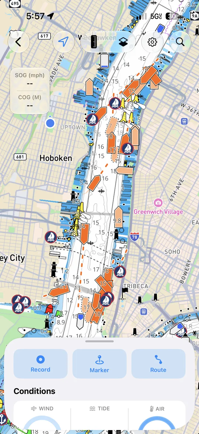
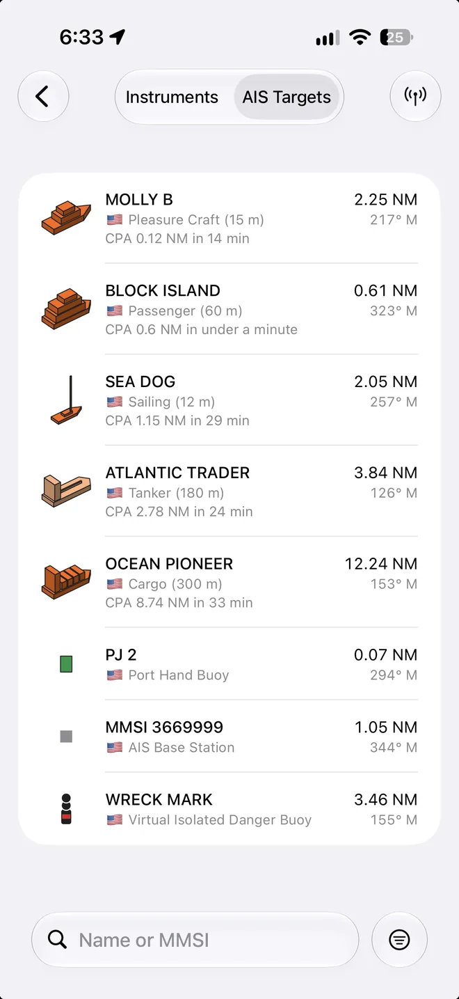
Connect OceanPulse to your boat's NMEA 0183 gateway or Signal K server over its WiFi. The AIS traffic around you draws on the chart as real hulls, with where each ship is headed and where it's been, and the target list puts the ones that will pass closest first.

Every vessel
Know who's out there
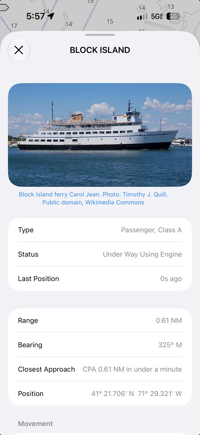
Tap a ship for its name, type, flag, speed and course, size, destination, and how close it will pass you. For vessels in US waters, OceanPulse adds the registry details: year built, tonnage, hailing port, and the operator, with a photo for many.
- Closest approach first
- The target list sorts every ship by how near it will pass, and when. Tap one and the chart flies to it.
- Close approach alarm
- Pick a distance, and OceanPulse alerts you when a vessel will pass inside it in the next 15 minutes.
- Details offline
- The US vessel details come with the app, so they show with no signal. Photos need a connection.
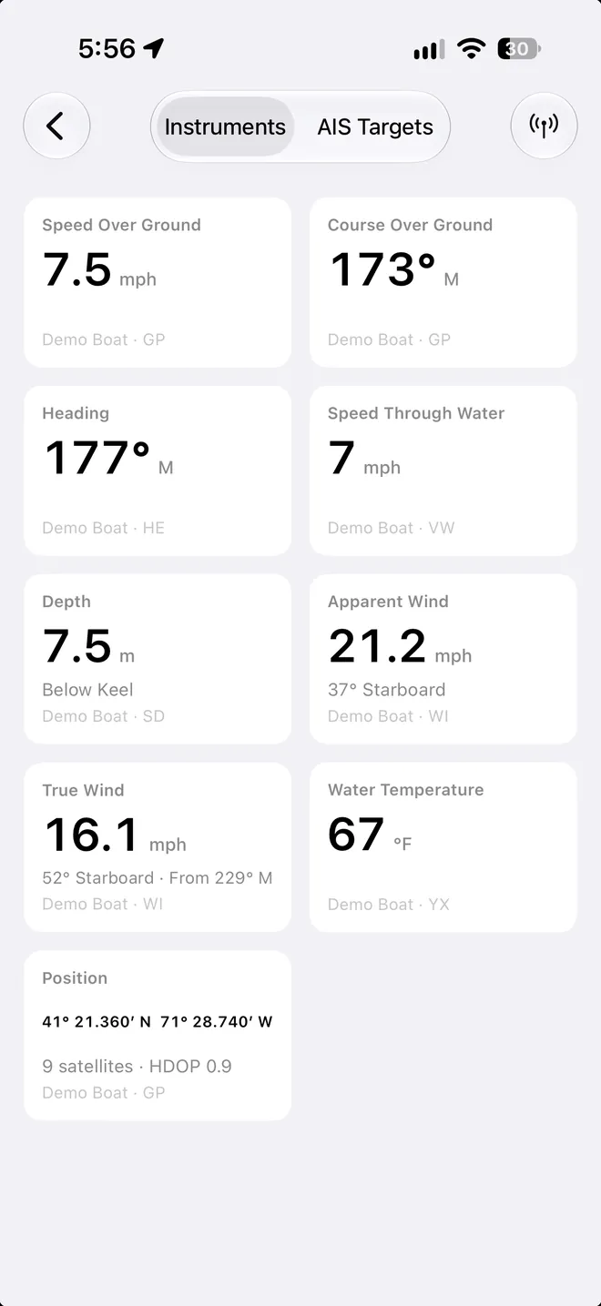
Your instruments
Your boat's numbers on one screen
Speed over the ground and through the water, depth, apparent and true wind, heading, and water temperature, each with the instrument it came from. A reading greys out when its instrument stops sending.
- The boat's GPS
- Use the boat's GPS for your position on the chart and across the app, and fall back to this device's GPS when it stops.
- Works with your gear
- WiFi gateways from Yacht Devices, Actisense, Digital Yacht, Quark-elec, ShipModul, and Vesper, and Signal K servers such as Victron's and the Raspberry Pi.
- Try it ashore
- Demo Boat plays a recorded passage off Point Judith, Rhode Island, with simulated AIS traffic.
User guide
Learn NMEA Connect inside out
Connect OceanPulse to your boat's NMEA 0183 WiFi gateway or Signal K server. See the AIS traffic around you on the chart, get a close approach alarm, use the boat's GPS for your position, and read speed, depth, wind, and heading on one screen.
There's more
More from OceanPulse
- Coastal Charts Official NOAA charts for the US, the Great Lakes, and US territories, plus the major inland rivers, with markers, routes, and offline downloads.
- Tracks Record your trips and share them live as you go (Elite), then review, search, and export them, with distance, time, and speed for each.
- Forecast Alerts Set the wind, waves, tide, and weather you want at a spot, and get a push or an email when the forecast matches.
- Anchor Alarm Leave an iPhone or iPad aboard to watch the anchor. It sounds an alarm if the boat drags, loses GPS, or runs low on battery, and your phone follows along ashore.
- Weather Routing Pick a start, an end, and a departure time, and watch GFS, ECMWF, and AIFS race to the fastest route for your boat, with every hour of wind and seas along the way.
- Climate Ten years of wind and wave roses, rain, pressure, and sea temperature for every month, anywhere at sea, to plan a passage for the right season.
Ready to dive in?
Start using OceanPulse today.