Tools · Tracks
Every run, logged.
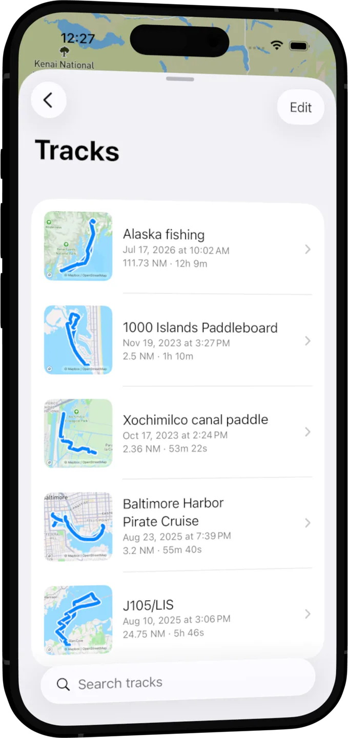
Tap Record and go. OceanPulse logs your course in the background, then keeps every trip with its distance, time, and a speed chart you can scrub through.

Set and forget
Recording that keeps going
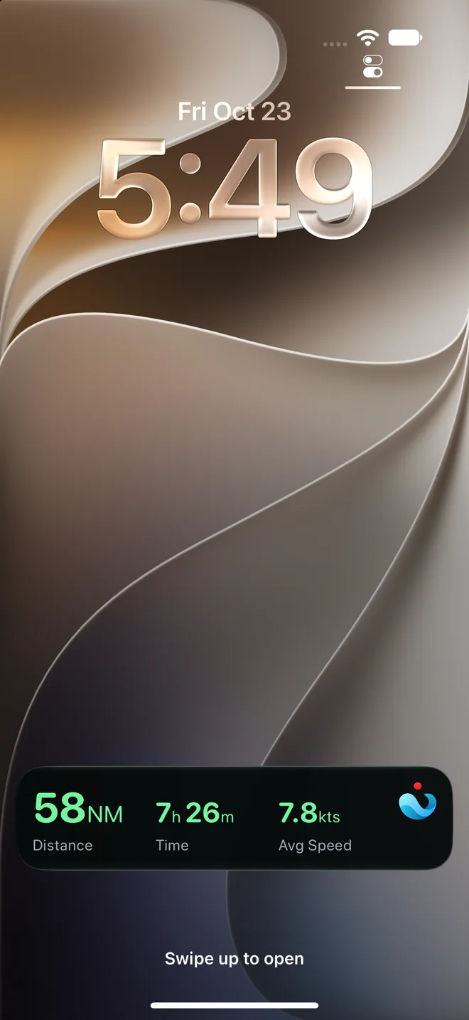
Lock your phone or switch apps and the track carries on. A Live Activity keeps the distance, time, and average speed on your Lock Screen, and every point is saved as it's recorded, so even a crash loses nothing.
- Pause and resume
- Stop for lunch without logging the anchorage; a pause leaves a clean gap in the line.
- Start from the chart
- Tap Record on Coastal Charts and watch the line draw behind you.
- On every device
- Your tracks sync between your iPhone and iPad through iCloud.
Your logbook
Relive every trip
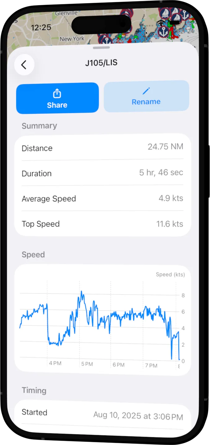
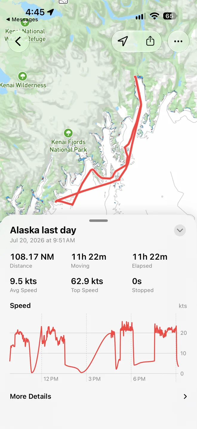
Open a track to see it on the map with its distance, moving and elapsed time, average and top speed, and time stopped. Drag along the speed chart and a marker shows where you were at that moment.
- Find any trip
- Search by name, sort by date, distance, or duration, and pin the ones you keep coming back to.
- On the chart, too
- Your saved tracks show faintly on Coastal Charts, so last season's line is there when you need it.
- Bring your history
- Open a GPX file from Files, Mail, or AirDrop and it joins your tracks.
Made to be shared
Show where you went
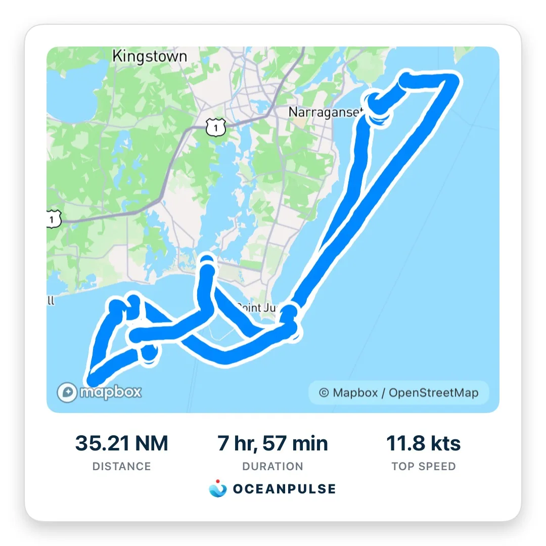
Turn any trip into a card with your route, distance, time, and top speed, ready for Photos or straight into an Instagram story. Or send a web link anyone can open, or a GPX file for their chartplotter.
Live Track Sharing
Let them follow along
Send a link while you're recording and family and crew ashore watch your track grow on a chart, in OceanPulse or any browser. No account needed to follow.
- Built for crossings
- Out of signal for days? Positions wait on your phone and catch up the moment you're back in range.
- Follow in the app
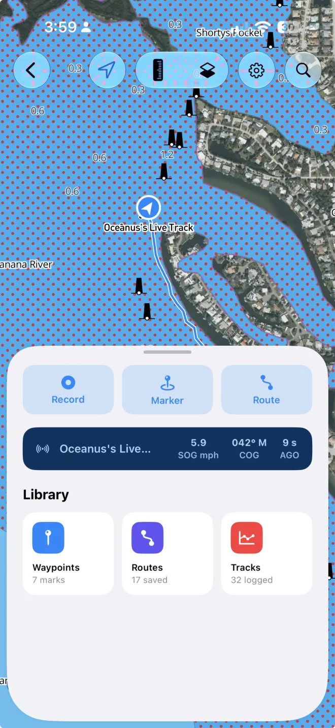
- Open a live track link in OceanPulse and the boat appears on your chart, with its speed, heading, and when it last reported.
- You decide when it ends
- Stop sharing and the link ends at once. Save the trip and followers keep the finished track for 24 hours.
User guide
Learn Tracks inside out
Record your trips in the background, share them live as you go, then review, search, share, and export them, with distance, time, and a speed chart for each.
There's more
More from OceanPulse
- Coastal Charts Official NOAA charts for the US, the Great Lakes, and US territories, with markers, routes, and offline downloads.
- Forecast Alerts Set the wind, waves, tide, and weather you want at a spot, and get a push or an email when the forecast matches.
- Daily Summary Ten days for every place you've saved, each split into morning, afternoon, evening, and overnight.
- Weather Maps Wind, waves, currents, sea temperature, rain, and more, animated across the whole planet three days ahead, with a split view to compare models.
- Tables & Graphs A ten-day, hour-by-hour forecast grid for any place, with Apple, GFS, ECMWF, and AIFS side by side.
- Tides & Currents Offline predictions at about 5,800 NOAA tide and current stations, with high and low water, slack, and max flood and ebb.
Ready to dive in?
Start using OceanPulse today.