Tools · Coastal Charts
Official charts. Built for your boat.
NOAA charts for the US, the Great Lakes, and US territories, sharp at every zoom, shaded for your boat's depths, and yours offline for free.


Read the water
Your depths, at a glance
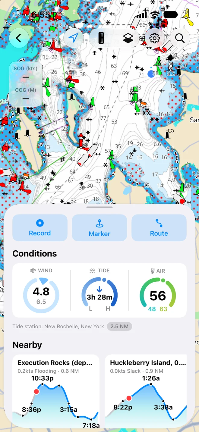
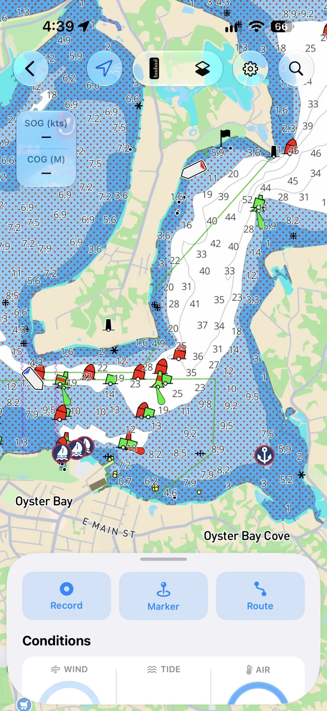
Tell OceanPulse what your boat draws. Shallow water shades dark and lightens as it deepens, and anything under your safety depth is hatched in red, so the water to stay out of stands out before you're in it.
- Tap for plain English
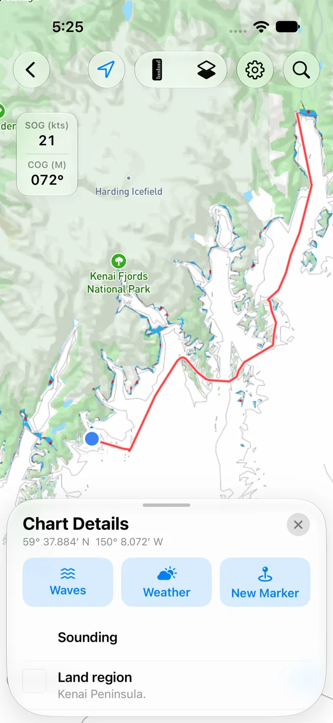
- Tap any buoy, light, wreck, or bridge and Chart Details tells you what it is, its colour, its light, and its clearance.
- Course up when you want it
- Follow your position north up or course up, with your speed and course over ground on screen.
- Measure anything
- Drag the caliper between any two points for the distance and bearing, or press and hold to measure from you.
Plan the run
Routes that know your boat
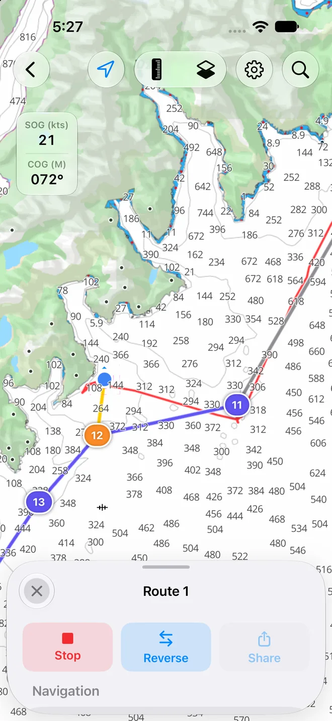
Tap the chart to lay down waypoints and see the distance, time, and fuel for the whole run, worked out from your boat's cruise speed and burn. Then tap Start and follow it.
- Bearing, distance, and ETA
- To the next waypoint and the end of the route, from the speed you're actually making good.
- Markers for your spots
- Drop a marker on a reef, a wreck, or a mooring, give it an icon and colour, and check its forecast.
- GPX in and out
- Share markers, routes, and tracks as GPX for your chartplotter, or as a link anyone can open.
Weather on the chart
See the wind where you'll be
Lay the forecast wind right over the chart and drag the timeline up to three days ahead. With Pro, add radar, currents, waves, and sea temperature.
- Wind for free
- Speed and direction, animated over the water, from the forecast model you choose.
- Radar, currents, waves, and sea temperature
- The last four hours of rain, the surface current, the sea state, and how warm the water is, on the same chart, with Pro.
- The forecast for any spot
- Press and hold anywhere on the chart for that point's hour-by-hour forecast.
Offline charts
Charts that come with you
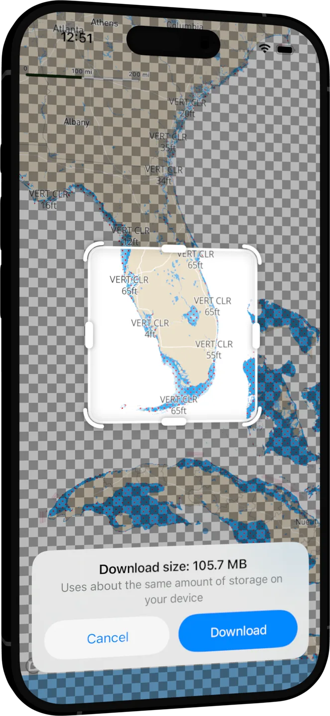
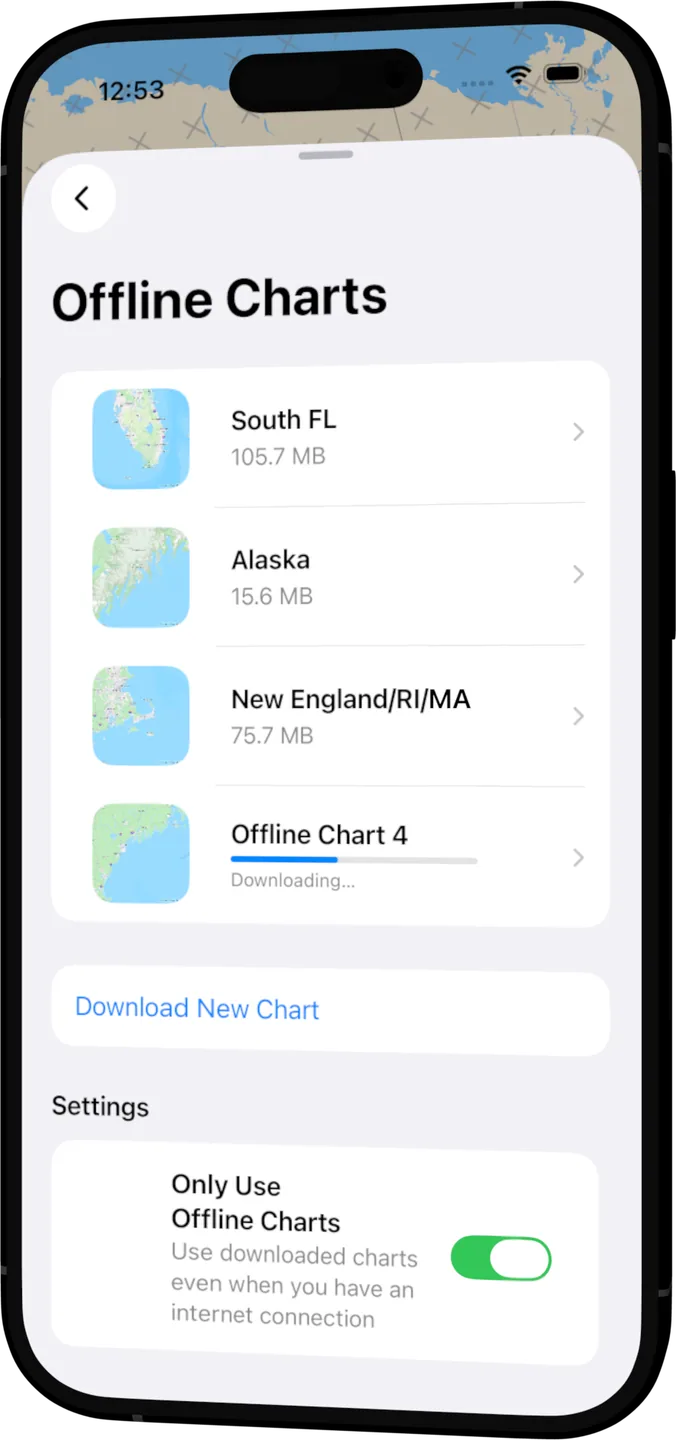
Download as many chart regions as you like, free. See the size before you start, let it finish in the background, and navigate on them with no signal at all.
- Updates when NOAA publishes
- A chart with newer data says so; update it and the old one stays usable while it downloads.
- See exactly what you have
- Turn on Only Use Offline Charts and everything you haven't downloaded is hatched.
On iPad
A chart table at the helm
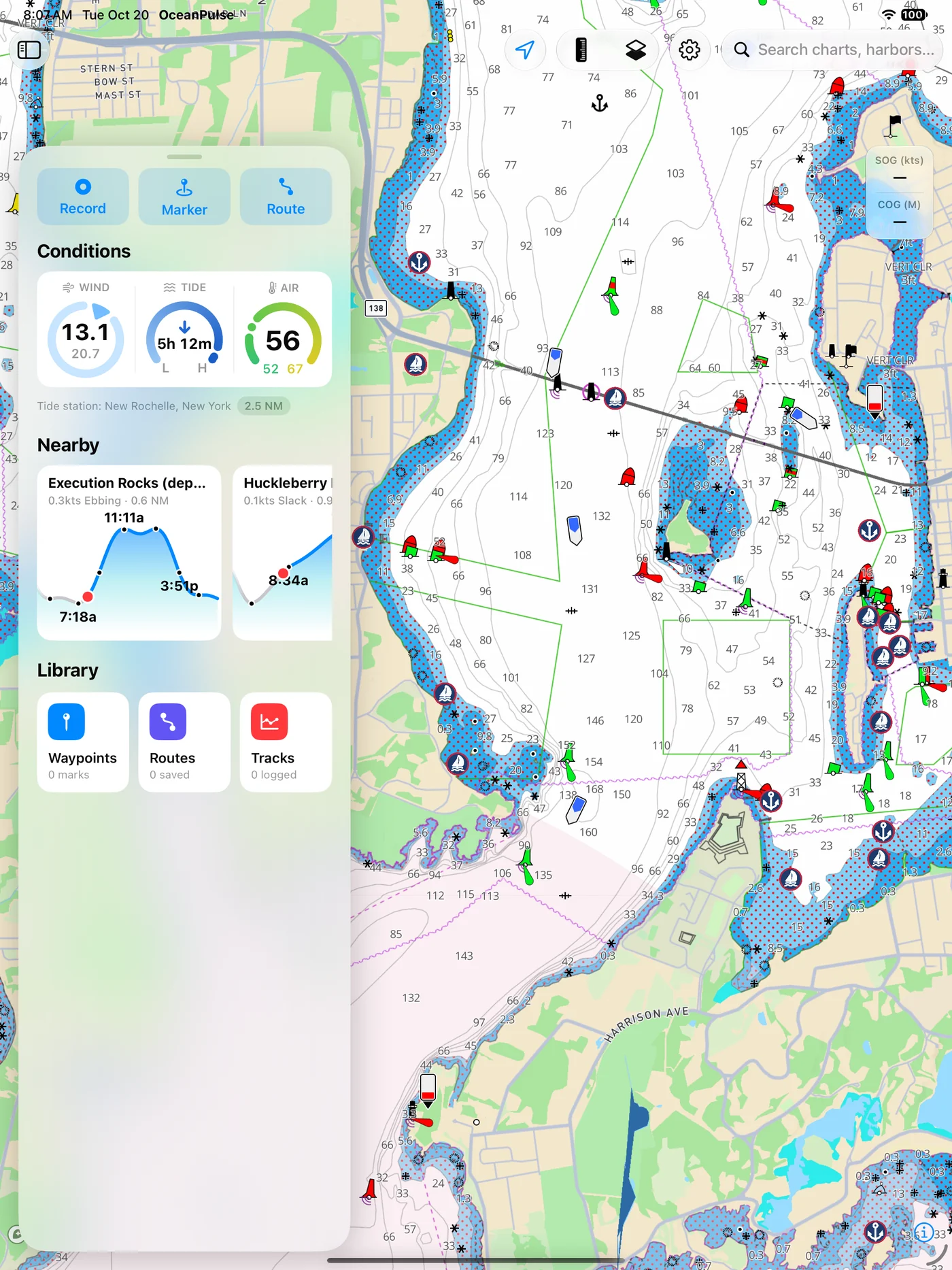
The whole chart on the big screen, with your conditions, nearby marinas, and saved routes in a panel alongside.
User guide
Learn Coastal Charts inside out
Navigate on nautical charts with your position, depth shading, and a safety depth, drop markers, plan and follow routes, lay the weather over the water, and download charts for offline use.
There's more
More from OceanPulse
- Tracks Record your trips and share them live as you go, then review, search, and export them, with distance, time, and speed for each.
- Forecast Alerts Set the wind, waves, tide, and weather you want at a spot, and get a push or an email when the forecast matches.
- Daily Summary Ten days for every place you've saved, each split into morning, afternoon, evening, and overnight.
- Weather Maps Wind, waves, currents, sea temperature, rain, and more, animated across the whole planet three days ahead, with a split view to compare models.
- Tables & Graphs A ten-day, hour-by-hour forecast grid for any place, with Apple, GFS, ECMWF, and AIFS side by side.
- Tides & Currents Offline predictions at about 5,800 NOAA tide and current stations, with high and low water, slack, and max flood and ebb.
Ready to dive in?
Start using OceanPulse today.