Forecast · Solunar
The sun and moon, anywhere.
Sunrise, sunset, every twilight, and the moon for any place on Earth, worked out on your phone so it's there a hundred miles offshore.


Plan around the light
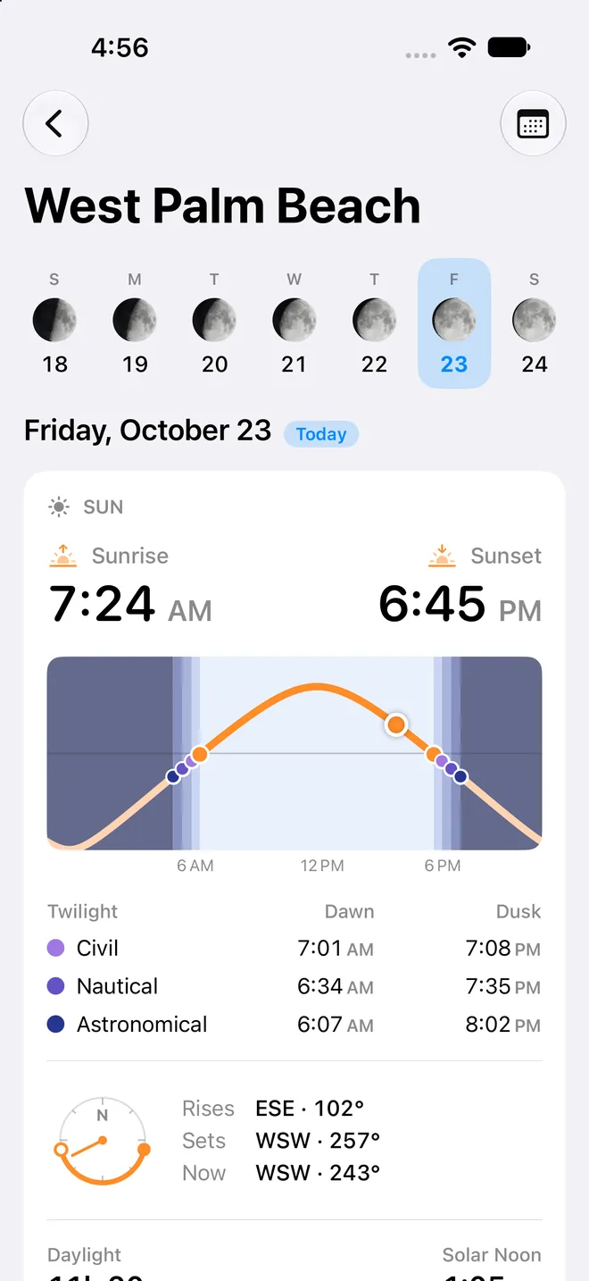
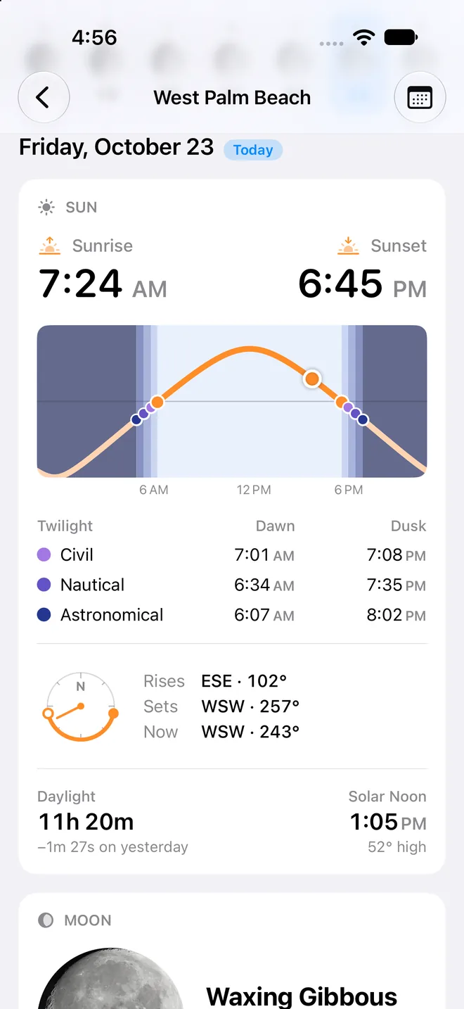
Know exactly how much day you've got
Sunrise and sunset are only half of it. Solunar lays out civil, nautical, and astronomical twilight on a chart of the whole day, so you know when you'll lose the horizon, not just the sun.
- Every twilight, dawn and dusk
- Civil for working on deck, nautical for the last sight of the horizon, astronomical for true dark.
- True bearings
- Where the sun and moon rise and set, on a compass dial, so you know which way to look.
- Gaining or losing
- How long the day is, and how much it changed since yesterday.
A moon worth looking at
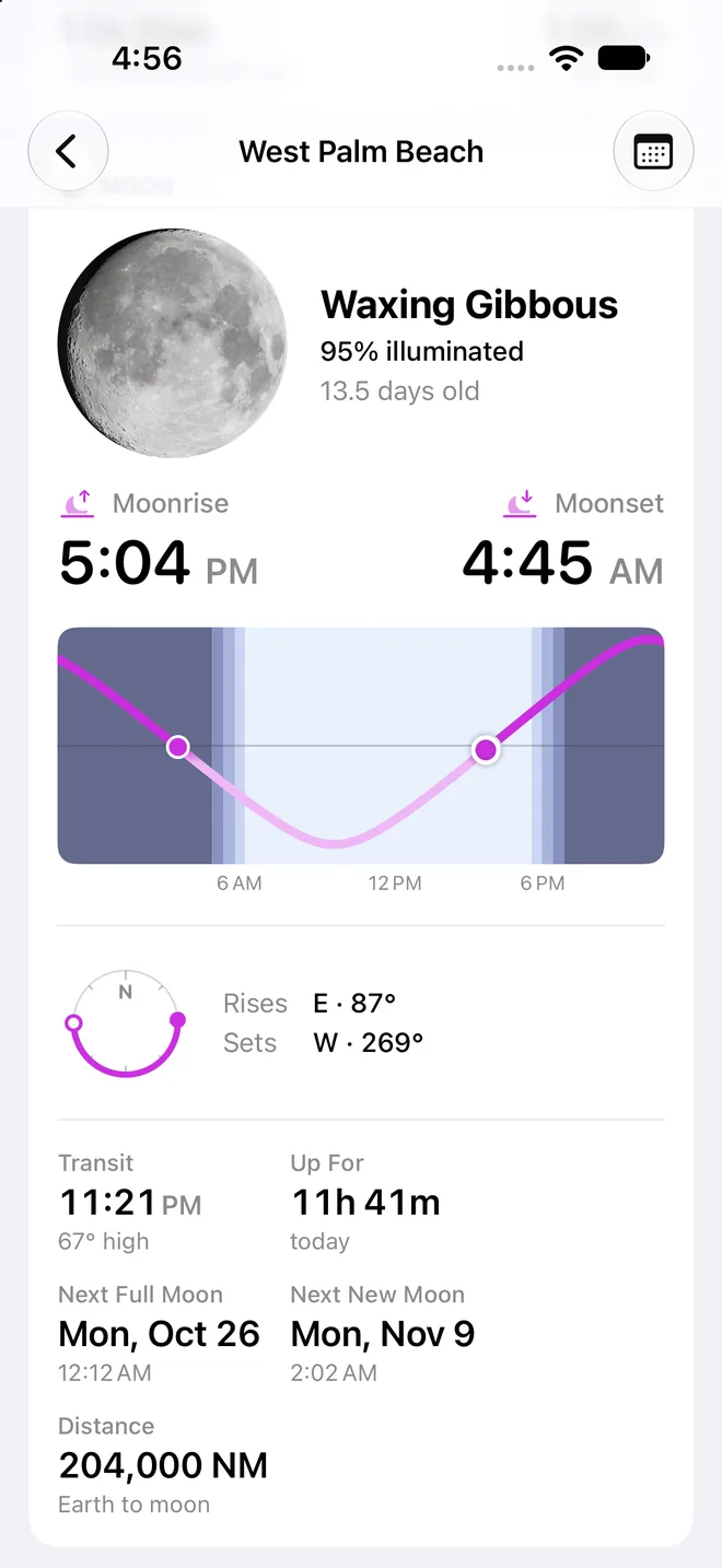
The real moon, as you'll see it
Solunar draws the moon from NASA's maps of its surface, lit for tonight's phase and tilted the way it looks from where you are. Then come the numbers: rise, set, transit, illumination, and age.
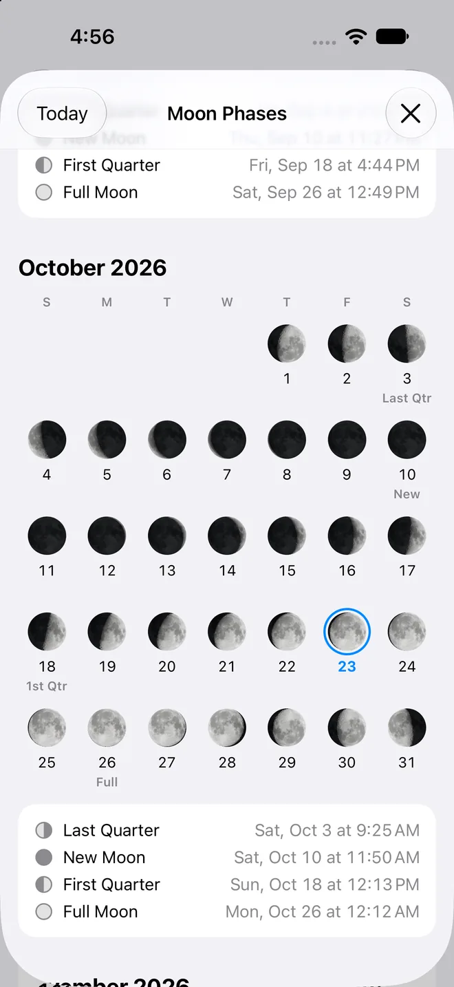
- Months ahead
- The Moon Phases calendar shows every new, quarter, and full moon to the minute, up to two years out.
- Supermoons flagged
- A badge marks the full moons that come closest to Earth.
- No signal needed
- Every time is calculated on your phone and checked against the US Naval Observatory.
User guide
Learn Solunar inside out
Sunrise, sunset, every twilight, and the moon's rise, set, and phase for any place, worked out on your device so it works offline.
There's more
More from OceanPulse
- Daily Summary Ten days for every place you've saved, each split into morning, afternoon, evening, and overnight.
- Weather Maps Wind, waves, currents, sea temperature, rain, and more, animated across the whole planet three days ahead, with a split view to compare models.
- Tables & Graphs A ten-day, hour-by-hour forecast grid for any place, with Apple, GFS, ECMWF, and AIFS side by side.
- Tides & Currents Offline predictions at about 5,800 NOAA tide and current stations, with high and low water, slack, and max flood and ebb.
- GMDSS Official marine safety broadcasts and warnings, read for you and placed on the map.
- Coastal Charts Official NOAA charts for the US, the Great Lakes, and US territories, with markers, routes, and offline downloads.
Ready to dive in?
Start using OceanPulse today.