Tools · Weather Routing
Let the weather pick the route.
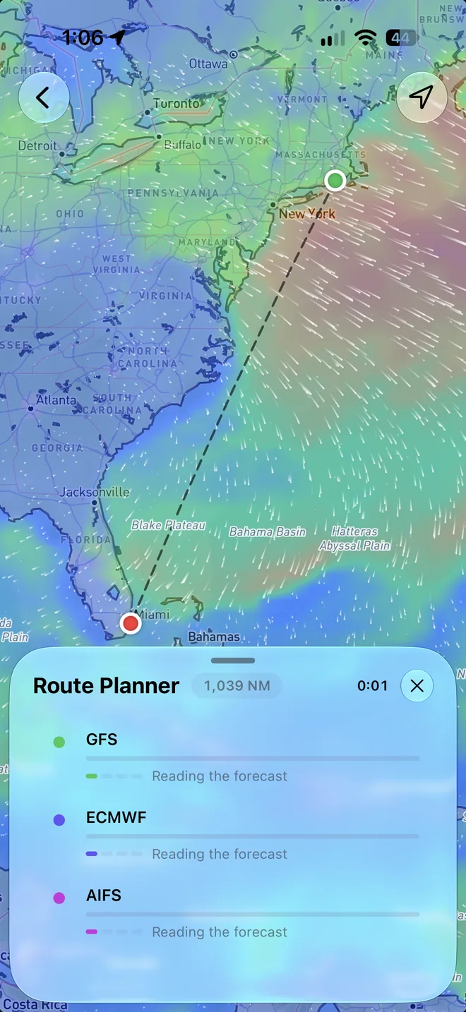
Tap where you're leaving from and where you're going, and pick when to go. OceanPulse routes your boat on three wind models at once and races them on the chart, so you see where the forecasts agree before you commit.


Every model
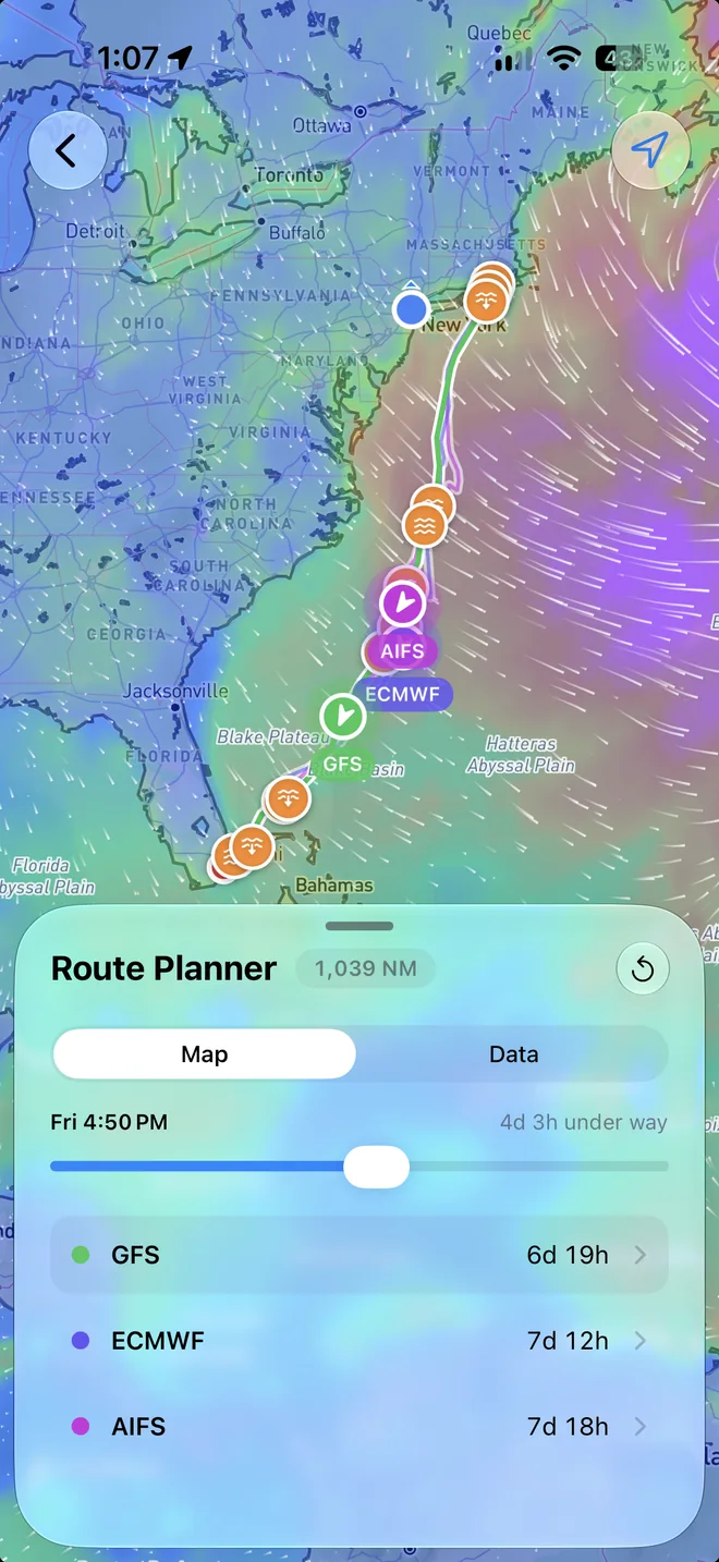
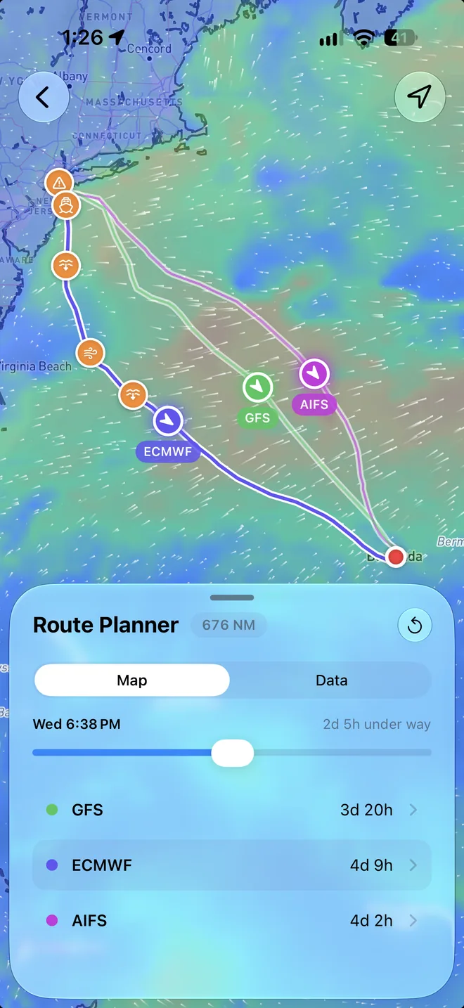
Three forecasts, one race
Every passage routes on GFS, ECMWF, and AIFS wind together. Each model's line grows on the chart as it's worked out, so you watch them race, then compare where they go and when they arrive. When they agree, you can go with confidence. When they don't, you know to look closer.
- Currents on board
- Ocean currents push the boat along or hold it back, and the sails feel the wind over the moving water.
- Past the end of the forecast
- Long passages sail on with NOAA's long-range wind, up to 60 days from departure, and say so wherever they do.
- Leave when it suits
- Pick any departure from three hours ago to ten days ahead, and route it again for a different day.
Your boat
Routed for how you sail
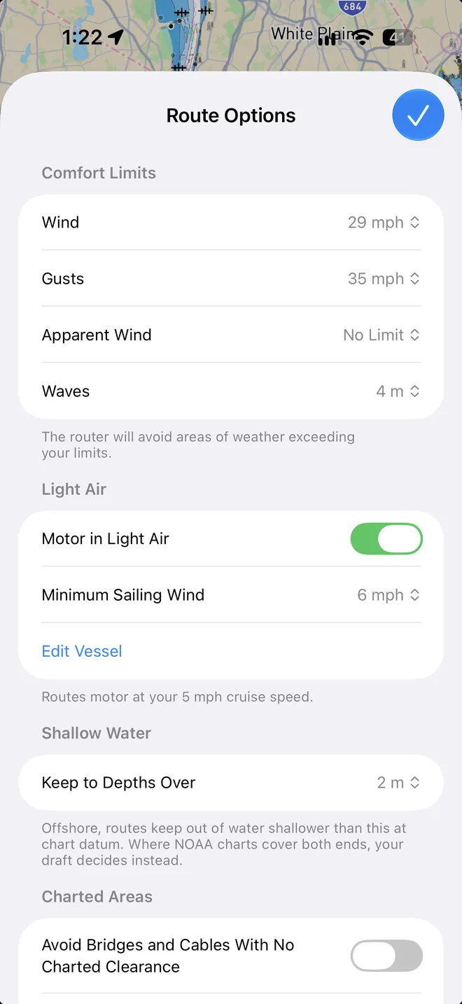
Tell OceanPulse about your boat once, on the Vessel screen. Sail or power, monohull or catamaran, its waterline, draft, and air draft. Import your own polar, or start from the generic one and set how hard you sail it.
- Comfort limits
- Set the most wind, gusts, apparent wind, and waves you'll take, and routes go around the weather that's over them.
- Light air
- Motor at your cruise speed when the wind drops below your minimum sailing wind, or wait for it to fill in.
- Your polar
- Import the polar file you already use in other routing apps, then set your performance from 60 to 100%.
- On the chart in US waters
- Where NOAA charts cover both ends, routes keep to water deep enough for your draft and pass only under bridges and cables high enough for your mast.
Every hour
Know the passage before you leave
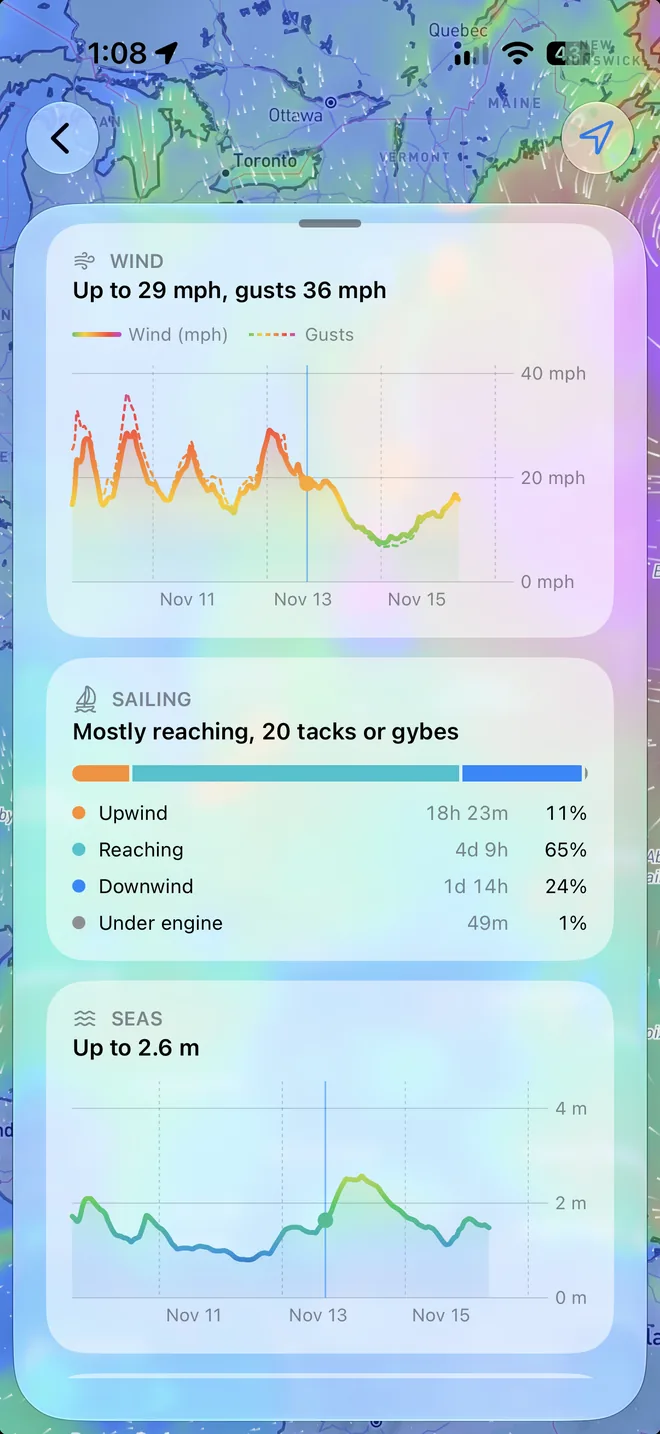
Drag the time scrubber and the boats and the wind move along every route together. Open a route for its Data: when it arrives, how far it sails, how much of it is under engine, and what to watch out for.
- Watch Out
- Wind, gusts, or seas over your limits, wind against current, shallow water, traffic separation schemes, and more, each marked on the map.
- Wind and seas charts
- The wind and the waves along the whole passage, coloured by strength.
- Hour by hour, and CSV
- A table of every hour's wind, boat, waves, current, weather, and chart depth, and the same as a CSV file to take anywhere.
User guide
Learn Weather Routing inside out
Route a passage for your boat on GFS, ECMWF, and AIFS wind at once, with currents, your polar, your comfort limits, and NOAA charts near shore, then read every hour of it.
There's more
More from OceanPulse
- Coastal Charts Official NOAA charts for the US, the Great Lakes, and US territories, plus the major inland rivers, with markers, routes, and offline downloads.
- Tracks Record your trips and share them live as you go (Elite), then review, search, and export them, with distance, time, and speed for each.
- Forecast Alerts Set the wind, waves, tide, and weather you want at a spot, and get a push or an email when the forecast matches.
- Anchor Alarm Leave an iPhone or iPad aboard to watch the anchor. It sounds an alarm if the boat drags, loses GPS, or runs low on battery, and your phone follows along ashore.
- Climate Ten years of wind and wave roses, rain, pressure, and sea temperature for every month, anywhere at sea, to plan a passage for the right season.
- NMEA Connect Connect to your boat's NMEA 0183 gateway or Signal K server over WiFi. See AIS traffic on the chart with a close approach alarm, use the boat's GPS, and read its instruments.
Ready to dive in?
Start using OceanPulse today.