Rain Radar shows the rain that’s actually falling, measured by NOAA’s network of weather radars, as a loop of the last four hours. It’s part of OceanPulse Pro.
Open Rain Radar#
In the sidebar, under Conditions, tap Rain Radar. The map starts over the US and moves to your location once your device knows where you are. Tap Center on My Location at the top right to fly back to it at any time.
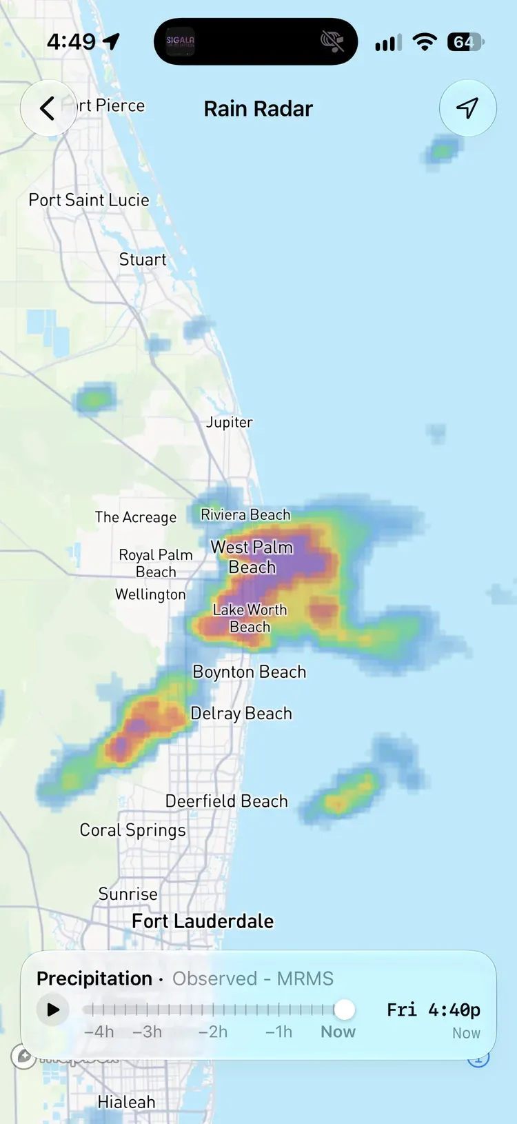
When rain is expected near you the home screen shows a radar card too. Tap it to open Rain Radar.
Play the loop#
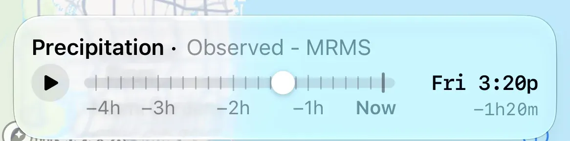
The card along the bottom reads Precipitation · Observed - MRMS.
- Tap play to run the last four hours. The loop ends on Now, pauses for a moment, then starts again.
- Drag the handle to step through the frames, one every 10 minutes. The readout on the right shows the day and time, with how long ago it was underneath, like −1h20m.
- While the frames load, the readout counts them in.
Read the colours#
Light rain shows light blue. Heavier rain runs through blue, green, yellow, orange, and red, to purple for the heaviest downpours, around 2½” (60 mm) an hour. The radar sees rain at about 1 km detail, sharp enough to pick single storm cells out of a line.
Radar shows rain that’s falling or has fallen. It doesn’t forecast. For rain in the hours and days ahead, use the Rain layer in Weather Maps or the Rain row in Tables & Graphs. Rain forecasts are global models and will not show the same level of detail as the radar.
Coverage#
Rain Radar covers the contiguous United States and the surrounding waters, as far as parts of southern Canada and the Bahamas. It also covers Alaska as far as its radars reach, from the Southeast to the Bering Strait, plus Hawaii, Puerto Rico and the Virgin Islands, and Guam and the nearby Mariana Islands. Everywhere else is hatched. The coverage map shows exactly where the radar reaches.
Radar on the chart#
The same radar can also be laid over the nautical chart in Coastal Charts, so you can watch rain move while you’re at sea.
Updates and connection#
NOAA’s radar mosaic adds a new frame every 10 minutes, and OceanPulse checks for one every 90 seconds while Rain Radar is open.
Rain Radar needs an internet connection. If it can’t load you’ll see Couldn’t load radar. Check your connection. Tap Try Again once you’re back online. If a later refresh fails, the four hours you already have stay on screen.
Pro#
Rain Radar is part of OceanPulse Pro.